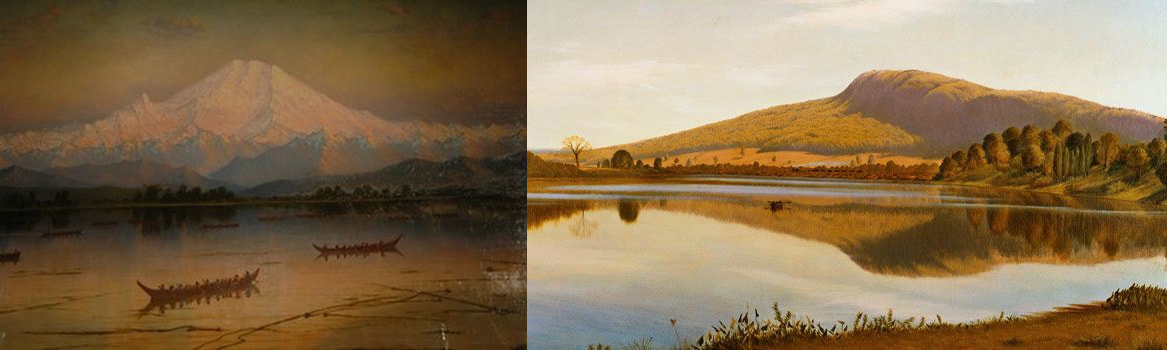
 14,411-foot Mt. Ranier (WA) and 935-foot Mt. Holyoke (MA): James Edward Stuart (1885), Thomas Farrar (1835) Although we say mountains belong to the country, actually, they belong to those that love them— Dōgen. Hikers from “out west” who visit New England will often scoff at what we call mountains here. It’s an understandable presumption—after all, our highest peak (Mt. Washington) tops out at 6,288 feet—a mere foothill when compared to the Cascade Range of the Pacific Northwest, with its many peaks above 9,000 feet, culminating in 14,411-foot glacier-bound Mt. Rainier. But that arrogance can easily be dispelled with a hike up our Mt. Washington in wintertime—where the meteorological brutality frequently matches that of the Himalaya, the Antarctic, or a Category 5 hurricane. A good winter ass-whipping and turn-around at the measly treeline of 4,500 feet can’t help but make a person wonder exactly what qualities are prerequisite to the term mountain. 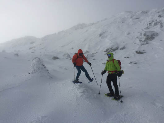 Hikers struggle to stand in wind on the slopes of Mt. Washington in winter. We turned around here, about 1 mile from the summit. In the northeast United States, the term mountain is applied quite liberally without much consideration to elevation. So, for instance, in the lower Connecticut River Valley of New England, in the Metacomet Ridge landform (a layer of volcanic strata tilted upward to form a line of cliffs extending from Long Island Sound to Greenfield, Massachusetts) there are many named “mountains.” The highest “peak” in the range is 1,202-foot Mt. Tom in Holyoke, Massachusetts; the lowest, Saltonstall Mountain in Branford, Connecticut, is only 320 feet high. But the Ridge and its peaks exist in stark contrast to the relatively flat valley of the Connecticut River (>60 feet above sea level in MA, lower in CT). The sharp and imposing cliff faces of the Ridge, up to 100 feet high, are a formidable visual and physical mountainous barrier. On the Metacomet Ridge there are also plenty of peaks called hill that are equally rugged but higher and more imposing than Saltonstall Mountain. Connecticut’s Hanging Hills for instance (high point 1,024’) —to further confound consistency-- contain two prominences called “peaks” and two more called “mountain.” The Hills present a massive, cliffy wall when viewed from the city of Meriden. 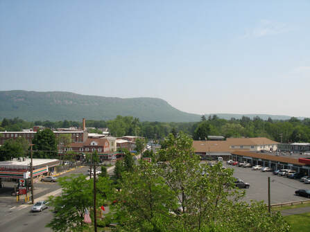 The imposing cliffs of the Metacomet Ridge on Mt. Tom loom over Easthampton, MA (Photo: Sash Kopf)
The famed mountains of Acadia National Park in Downeast Maine reach only as high as 1,527 feet (on Cadillac Mountain) but when viewed from a ship or nearby island, rise out of the sea so impressively they seem like the Himalaya. And yet early European explorers of New England routinely called the much higher White Mountains of New Hampshire, the White Hills. Distilling from the above, one could say that perspective and topographic contrast might be two relative prerequisites for calling something a mountain, while elevation itself is mostly meaningless. The whole tally of mountain-prerequisites might include:
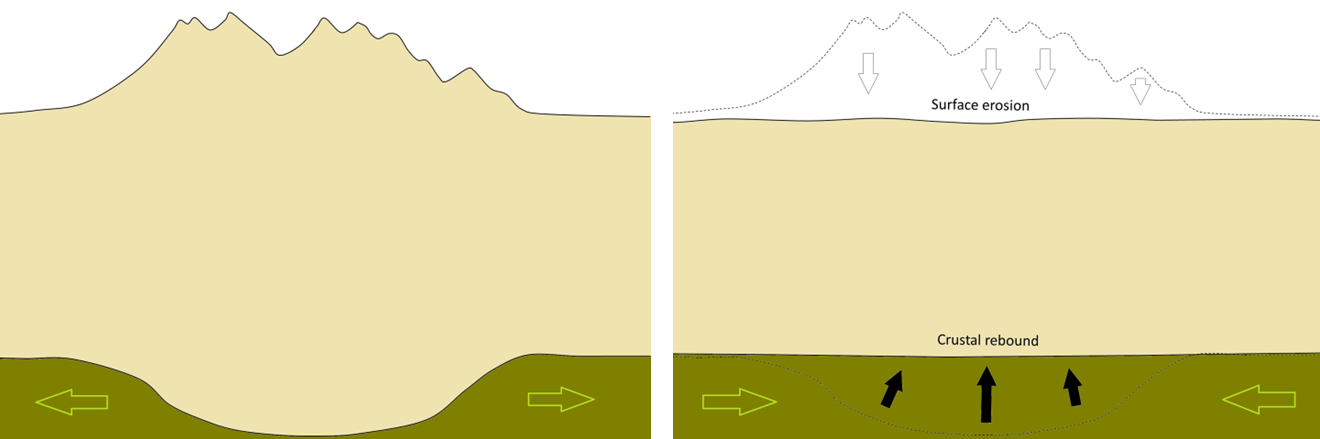 Istostacy (Source: Karla Panchuk (2018) CC BY 4.0, modified after Steven Earle (2016) CC BY 4.0) What about earth science? To geologists, mountain and hill aren't scientific terms. Mountains and hills are elevated landforms, and elevated landforms arise from a wide variety of geologic forces. Volcanoes and continental collisions are obvious causes, but erosion and isostacy (land rising or sinking by way of weight and pressure differences in the earth’s crust and mantle) are also responsible. Erosion can create “mountains” by gouging out a flat plateau (the origin of the Catskill Mountains); isostacy in cooperation with erosion can raise “mountains” like magic from a pancake-flat plain. For instance, the Appalachian Mountains were ground down to sea level more than once, then rose up again—go back 100 million years and the location on the continental plate where Mt. Washington now exits was the floor of a valley, and the location of Pinkham Notch was a hill above it. To a geologist, what laypeople call mountain is just another chunk of crustal rock subjected to the contortions and abrasions of our planet Earth.  Japanese painting of mountains, 1760 If science is no help, what about language? The Merriam Webster Dictionary defines mountain as “a landmass that projects conspicuously above its surroundings and is higher than a hill.” For contrast (and with a bit of circular logic), it defines hill as “a usually rounded natural elevation of land lower than a mountain.” Similarly, the Cambridge Dictionary defines mountain as “a raised part of the earth's surface, much larger than a hill, the top of which might be covered in snow” and hill as “an area of land that is higher than the surrounding land.” So, per dictionary, the only real difference between a hill and a mountain is a matter of elevation contrast: a mountain offers a lot of topographic contrast, a hill not so much. The word mountain is itself derived from the Old French montaigne, which is in turn derived from the Latin word mons, which essentially meant the same thing to the Romans as mountain means to us—including all the ambiguity. But, interestingly, mons is derived from the Proto-Indo-European “mnā-” which means “to think.” The evolution of language is based on such extrapolations: new things and concepts that are intuitively relatable to the familiar start out with hand-me-down names. We continue to do this today: for instance root is the subterranean part of the plant from which the rest of the plant seems to arise; we use that same word to associate conceptual origins: the root of all evil, the root of the matter. We haven’t yet evolved a new word for this nuanced construction in English. Maybe it was the same for the linguistic root mnā- as it related to mountains.  Buddhist monastery on mountainside in Tibet (Photo: Douglas J. McLaughlin; link in image) As the ancient ancestors of human beings evolved, they moved from the trees, to the forest floor, to the plains, and, last of all, to the mountains (and the sea). The mountains and the sea were the last external frontiers of humanity, two great forces of nature that were inarguably much larger than us, frightening abodes of gods, devils, and elemental forces that could not be tamed. The mind has always been the last internal frontier. One can look at mountains from afar but to actually go into the mountains requires some courage and some tolerance of risk and the unknown, a willingness to expand one’s consciousness through uncertainty and danger. To risk not-being. To think is likewise a practice and expansion of stark contrast and risk; from the plain of unthinking (the animal mind) rise thoughts which challenge an existence based on simple urges. Thoughts are potentially as dangerous as they are rewarding; they are massive and contrasting when compared to thoughtlessness and instinct; they potentially have no end, and what ends they have are only available to the curious and risk-taking. And I say, there you have it. There is something conceptually human in the term mountain. To think is to imagine and by imagination conceive ideas; mountains, with all their topographic challenges, inaccessible crags and impassible cliffs, secret valleys and snowy tops, are rightfully objects of our imagination more than they are simple landforms defined by mere elevation. Our mythology and history contain innumerable instances of people going to the mountains to find the divine, themselves, peace, harmony with internal and external nature, freedom, and challenge: all endeavors which involve the use, expansion, ingenuity, or wise management of the human mind. Maybe it is that challenge, an essential part of being human, which stands at the core of the term mountain. --Paul-William 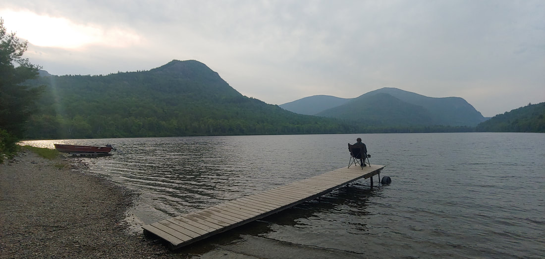
0 Comments
Misunderstandings about how smartphone GPS and hiking map apps work and the risk involved in relying on them aren’t just the province of fools and newbie hikers—a lot of older, experienced hikers tend to whet the edge of their criticism of GPS apps and app users on their own unfamiliarity with How Things Work, and from the perspective of younger folks born into info-tech, their attitude toward it rings a bit too much like typical stone-age boomer contempt. Given how rapidly smartphone GIS tech has advanced in a short period of time, keeping up with it all a challenge. So, let’s break it down, shall we? Maybe the best place to start is at the beginning. . . in the true Stone Age.
Maps that rely on memory alone are inherently unreliable as a community resource because navigation through memory relies heavily on the abstract and relative importance of certain landscape cues instead of on actual geometry and scale. When a cognitive map is translated onto paper, distance and proportion are (more or less) distorted (this is a well-researched phenomenon, and you can try it at home for fun: without any reference materials, draw yourself a map of your neighborhood or town. Then go back and compare it to a street map). To make maps useful to more than just one person, humanity's cartographic toolkit had to evolve. That began with the discovery of the concepts of geometry and trigonometry (~200 BCE) which informed the practices of measurement and triangulation, while inventions like the compass (200 BCE), telescopic sight (1600s), and theodolite (1700s) made use of it. Older maps were constantly being copied and improved upon, and systems of measurement became more consistent. Global trade and exploration also helped hone accuracy, distribute map-making technology and knowledge, and promote the paper map as a common concept, but it wasn’t until the modern era (late 1700s) that topographic maps showing contour lines were invented. 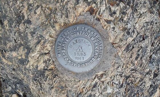 A Maine DOT survey control marker on Haystack Mountain in Aroostook County, ME Early topo maps were created by physically surveying extensive areas of land. Surveyors laboriously carted their instruments into the countryside, across rivers and over mountaintops, where they set up stations and triangulated between them to generate models of topography, which were then rendered on paper maps using the innovative method of drawing thin lines to represent intervals of elevation change (contour lines). These old-time surveyors make today’s hikers look like wimps; they made their way across the howling wilderness of the Adirondacks and White Mountains without the benefit of trail systems or modern hiking gear. Evidence of topographic surveying work can be found in those little bronze disks set into many of the rocky summits of the northeast. By the mid-1900s the practice of physical surveying was improved upon through the use of aircraft and satellites to remotely gather digital data which could then be modeled to show elevation intervals or relief through shading. Initially this was done through photogrammetry: the 3-D triangulation of images derived from two or more cameras facing the same geography from different angles, and most recently via lidar—special depth-sensitive laser systems mounted on aircraft. 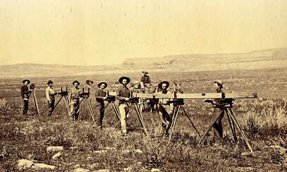 Surveyors carrying equipment in 1880s New Mexico (photo: Library of Congress) Creating maps from data is different than the process of creating maps from physical surveys. Digital geographic data sets can be rendered and manipulated very quickly and easily into novel, customized (and even interactive) maps through computer technology (including the tiny computers that most of us now carry around in our phones). THERE IS NO SPOON. . . At the end of the movie The Matrix, the protagonist Neo achieves an elevated state of consciousness that allows him to see the data code that underlies the virtual world in which he exists. Stubbing one’s toe in the Matrix isn’t the fault of the virtual wall that one stubs the virtual toe on, it’s the fault of the data from which the wall and the toe are derived. Likewise, it’s wise (red pill view) to think of the map you see displayed on your device as a vehicle for experiencing geospatial data, rather than as the product of the application itself (blue pill view). For the most part, geospatial data isn’t derived directly from the phone app or its developers—it’s a rendering of geospatial data collected, assembled, and curated elsewhere. Geospatial data comes in two main flavors: vector data and raster data. In a nutshell, vector data are individual geographic locations to which identifying information is assigned, and raster data are geographically referenced digital images.  Visual of vector data set of Maine lighthouses (point data). Vector data, composed of points, lines and polygons, is the basis of a good many elements in modern hiking maps, both GPS-app and paper maps. Points consists of single points (such as a mountain summit or a street address) assigned a latitude, longitude, elevation and other identifying characteristics (such as the name of the mountain or street name and number). Lines (rivers, roads, trails, etc.) are simply a series of directionally- connected points, and polygons (town boundaries, lakes, state park areas, etc.) are closed lines. Because each piece of vector data is discrete and individual but also sortable, vector data is very easy to customize in maps. For instance, a vector line showing the course of the Mississippi River can be rendered by script or map-making software in any color and any width, with or without border edges, etc., making it possible to show the river meaningfully in maps of any scale (this is called symbolization—we’ll get back to that later). Vector data is also relatively easy to create: when you track your hike on a GPS device or place a pin to mark your location, you’re creating simple vector data. Vector data can be stored and shared via databases, scripts (such as XML based scripts like .KML, .GPX. and OSM's .OSM), or even punctuation-delineated plain text. 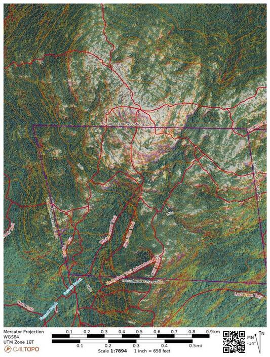 A NAIP aerial image (raster) of Monadnock with vector and raster overlays (OSM trails and public lands; contour lines, and raster-derived slope angle shading) Raster data is essentially a digital image that is geo-referenced to the latitude and longitude of the earth it is supposed to represent. Like all digital images, raster data is composed of pixels; each pixel in the image is assigned, through a matrix, geographic coordinates. Examples of raster data include aerial and satellite imagery, lidar data, vegetation cover maps (derived by analyzing color and contrast patterns in remote imagery), wildfire activity maps (infrared imagery rendered into visible-color heat-map images), etc. Any digital image can be georeferenced into a raster, regardless if it has geographic meaning or not: one can geo-reference a historic 1930s-era paper USGS topographic map (meaningful but out of date) or stretch a photograph of the face of actor Matthew McConaughey across the state of Texas (meaningless—maybe?). It is hard, with raster data, to manipulate discrete elements of geography in the image because (for instance) aerial photo pixels don’t care if they’re pixels of state highways, federal highways, or basketball courts—they’re all going to have the same asphalt-gray color in an image. Raster data are manipulated in the same way that we manipulate digital photographs—by making systemic changes based on contrast, color, brightness, depth, etc. The utility in that kind of systemic manipulation is in how it can make certain geographic patterns really stand out that wouldn’t otherwise be apparent to the naked eye. Raster data is typically stored in image format, either within a data package containing reference scripts that draw on sections of the imagery as it is needed, or within a database matrix, or as stand-alone georeferenced images or documents (GeoTiff and GeoPDF, etc.). MORE DATA THAN YOU CAN SHAKE A STICK AT The amount of geospatial data available today is staggering, and it originates from a wide variety of sources: governments, corporations, non-profits, and individuals (through crowdsourcing and social media sharing). For instance, much of our elevation data in the United States comes from the Department of Interior's United States Geological Survey, which gathers data via remote sensing (satellites, planes fitted with photographic equipment or lidar). Likewise, the United States Department of Transportation (USDOT) creates and manages data on the country’s primary highway systems and railroads, while states and municipalities create and curate GIS data showing minor roads, sewer systems, sidewalks, utility lines, state parks, etc. FEMA has datasets on flooding and flood zones. The CDC has data sets showing the locations of disease outbreaks. The National Park Service manages data on trails and points of interest in National Parks; the Forest Service does the same for their lands. Branches of governments of other countries have comparable data departments. Most government data (excluding military/intelligence agency stuff) are routinely made available free to anyone who wants to use it: individuals, municipalities, companies, non-profits, and public-service data clearinghouses alike. Many states support data clearinghouses that collect, vet, manage, and distribute GIS data and metadata; data.gov is the clearinghouse for data created by branches of the United States federal government. These data repositories often include interactive online GIS (not GPS) mapping that allows you to view and overlay the various available data. Data created by private companies (like Google for instance, or cell service providers who track the location of users and turn that data into a commodity) may or may not share their data sets, or restrict how it is used if they do share it. Data from non-profit organizations (The Nature Conservancy maintains huge geographic datasets on ecological resilience to climate change for instance) is often made available free of charge, and there is quite a body of it. "Crowdsource" data is generated by individuals who create and share data (usually for free) through apps or data clearinghouses (trail routes generated by users of AllTrails.com are crowdsource data). Crowdsourcing relies on the advantages of local knowledge; the accuracy of crowdsource data tends to increase in proportion to participation. When maps are made or there is a need to analyze geospatial data, these individual data sets are collected from their sources. Both Google and Open Street Map (OSM) make high use of publicly-available geospatial data. OSM—the free, non-propriety, and international alternative to Google—maintains vector and raster data sets assimilated from vetted public data sources (like USGS and USDOT) along with substantial crowdsourcing data (data created and/or curated by individual contributors at the local level) and feedback from professional sources ("prosourcing") that use OSM in their applications (Mapbox-- a company that specializes in creating GPS application development tools-- relies on OSM data, uses its applications to improve the OSM data, and then feeds the improved data back into OSM).  The OSM crowdsource mapping interface But the accuracy of geospatial data is only as good as the accuracy of data collection and the effort put into keeping it current. If, for instance, a city re-routes a road intersection but doesn’t immediately provide a data update, there will be a lag in accuracy which will in turn probably be reflected in Google Maps and OSM, whose data banks various smartphone apps rely on to create their maps. That inaccuracy may in turn be corrected sooner than the municipality can respond in the case of Google (who is drawing on the data stream of vehicle drivers using Google Maps applications) or OSM (where a prosource or crowdsource user notices the change and updates the data)—or the lag may persist longer. I’ve seen some intersection errors persist for several years in Google maps! Gallery: Two modern Monadnock maps (left, center) digitally derived from the same vector data but symbolized differently. The third map is a 1960 AMC map manually derived from an earlier USGS series print topographic map. DOES YOUR APP LOVE YOU, AND DO YOU LOVE YOUR APP? Many non-Google GPS apps that are available for smartphones rely heavily on free vector data compiled by OSM and other open public sources. Someone must decide how to display that geographic data visually as a recognizable map. This is called symbolization. Symbolization involves making rules to determine which data elements to display and which to hide, what the color, size (for instance width of roads and rivers, color of National Forest boundaries, etc.), character fonts, etc. will be like, and how they will look at different zoom scales. Many data sets come with already- encoded default symbolization which can be modified to a greater or lesser degree. Some phone apps will offer data sets symbolized by third parties; for instance, USGS has their own preferred map symbology (rendered stylistically similar to the old USGS print topo map series). Other GPS applications use their own customized, propriety symbol key, based on their own aesthetics and the perceived needs of their end-users. The better application developers (usually at higher subscription levels) will offer a both in-house and a variety of out-of-house custom symbolized vector-based maps as well as georeferenced raster maps (i.e. aerial imagery), often at the global level. Entire data sets may be too massive to live on your phone and must depend on an active internet connection (unless you pre-download portions of them).
Gaia GPS is perhaps one of the more popular apps that offers global coverage. A basic Gaia subscription (free) comes with Gaia’s own custom-symbolized vector-data map derived from OSM. A Premium subscription ($40 in 2021) offers a wide variety of third-party vector and raster-derived maps, and the ability to overlay vector data onto other vector data and raster data-derived maps (for instance, a layer showing contour lines over an aerial image). Because Gaia is built to tap global data (you can if you want, view secondary roads in North Korea for instance), it cannot curate and correct the data that it makes use of. If it were to do so, its application would be unaffordable to anyone except millionaires. With Gaia, you’re paying for global coverage and diversity of maps, not global custom curation or extremely high accuracy of discrete geographies (though much of the data it uses is in fact extremely accurate, and GAIA does offer curated National Geographic raster hiking maps at is premium subscription level).
For instance, FarOut (originally Guthook, presumably renamed to sound more hikerly and to trade in the creepy mental associations for. . .I don't know, hippie psychedelic ones?) is an application developer that got their start providing curated vector-data maps of the Appalachian Trail to through-hikers and section hikers. It’s affordable because the geographic coverage it services is in high demand (National Parks and the A.T. are popular; people will pay for intensively curated maps of them) and the geography is limited (a linear corridor, a park boundary). A full set of curated A.T. maps from FarOut costs (as of 2021) a reasonable $60. The custom route and trails feature data typically live on your phone once purchased; you don’t need an active internet connection to view them or find yourself on them (but you may need one to view the underlying OSM-derived basemap or satellite imagery basemap if you don’t tell FarOut to download it too). FarOut’s limitation, of course, is the depth of your wallet and lots of blank spots on the global map.
Avenza-purchased maps also typically live on your phone and don't require an internet connection. The accuracy of these maps depends on when they were published and how much has changed since then; because they are static, copyrighted images they cannot be tweaked until updated by the original copyright holder. Avenza is limited in the same way FarOut is limited—you pay per map, and there are lots of blank spots on the globe. Another drawback of Avenza is that it relies largely on static raster images: the map elements don't usually adjust when you zoom in or out-- print and features quickly become illegible as scale increases.
A fourth category includes applications that start with an OSM-derived basemap and overlay it with crowdsource data generated by users. AllTrails.com is probably the best known application on this front; it offers a no-frills OSM-derived basemap over which crowdsource-generated individual suggested hikes are presented: The crowdsource elements include a red line showing the suggested hiking route, a simple text description, an elevation profile, pins indicating feature points, and ratings and reviews of the hike from the application user community. Typically, the user-generated content (from both experienced hikers and complete greenhorns) is only minimally curated by AllTrails to eliminate the most egregious of errors and mischief (and then sometimes only after someone complains), but on the flipside Alltrails’ gigantic contributing user group captures some obscure and interesting off-the-beaten-path hikes, as well as many popular hikes. Because curation of user-content is sporadic, it's very important to scan the AllTrails user reviews: there, other hikers will share problems they had with the hike. Read the reviews to be informed before you go. If the reviews suggest that the hike is sketchy or not as described, you'll want to take that into consideration. It is also important to pay attention to the underlying OSM basemap, which may show additional trails and routes in the same area, and may show the actual names of the trails (instead of the contributor's name for the hiking route, which may co-opt more than one trail without mentioning it). Alltrails, rightly or wrongly, gets no end of shit from the elite hiking community: "rightly" because with any social media experience, you have to use your discriminating intelligence to help you decide which information is good, which is mediocre, and which is untrustworthy (instead of having someone conveniently do it for you-- provided you have discriminating intelligence of course). And "wrongly" because Alltrails is the poor man’s (and globetrotter’s) alternative to bankrupting oneself by purchasing individual, pro-curated hiking maps and guides for every geography one may visit and want to go hiking in. IS IT MY PHONE, OR IS IT ME? Most smartphone apps offer a variety of controls to help you view the map (or maps) and interact with it. Some of these features come with the basic subscription, while others require more dollars to activate. Features typically include the ability to move the map around on the touchscreen with your fingers, a cursor to locate yourself on the map, the ability to determine whether the map always points north or rotates in the direction you are heading, the ability for you to upload or create pins and hiking tracks to your map, the option to download sections of maps for use when you’re in an area with poor cell service, and the ability to share information with other users of the same app—among other functions. Sometimes these functions are engineered exceptionally well to work with a wide variety of smart phone device packages (make and model of phone, Apple or Android platform, etc.) but sometimes the design works less well on some phones (which results in certain quirks or failures). Note that you may have to tweak some of your phone settings to ensure that your phone and app are working together efficiently (battery use settings, location settings, screen use time out, app permissions and exceptions, etc.). Most modern smartphone devices are capable of locating you on the surface of the earth (latitude and longitude) with excellent accuracy via both cell phone towers and satellites (your elevation may be a bit less accurate). Essentially, the phone engages tower and satellite signals and triangulates your location from them. The GPS accuracy of smartphones these days is equal, or nearly so, to most non-survey grade dedicated GPS devices (like many Garmin models). Even if you switch to airplane mode your smartphone can still geographically locate you in a map application by sensing those signals (unless you’ve disabled that functionality on your phone). This accuracy will vary depending on obstructions. If you’re underground or within a building with thick walls, you won’t be able to pick up satellites or cell towers, and so your phone won’t know how to locate you on a map. Likewise, accuracy will be reduced if you are under a heavy tree canopy covered with snow, within a building, or if you are standing near a large object capable of reflection —a building, vehicle, or cliff face for instance—which may cause signals to bounce around, scrambling triangulation a bit. In the best of conditions accuracy is usually within sixteen feet.
Battery life is map life. Battery life is highly variable and depends on your phone make and model, how old your battery is, and how many other apps you’re simultaneously running (in the background and foreground). Newer, higher end models can last as much as five or more hours while tracking (tracking your hike is a significant drain on battery life). Older, cheaper phones may burn out in an hour or so while tracking. Some phones (i-phones are notorious for this—really, it should be a crime) will falsely register cold weather as low battery function and will spontaneously shut down when temperatures drop below freezing—even if the battery is fully charged (older i-phone batteries tend to do this with heinous frequency). Once you run out of battery life, unless you have a paper map as backup—or excellent geographic memory—you’re pretty much flying blind. You can conserve battery energy by closing unused apps and limiting background app function (airplane mode), pre-downloading maps of the area you plan to hike in, checking your display conservatively, turning off your phone during overnights and long breaks, and limiting your route tracking. If you have an old phone with a weak battery, you might want to consider a phone upgrade. If you do upgrade, you may want to consider a model with a larger screen, so that you can more easily view maps.
Needless to say, exposure of the phone to the elements and hardships of hiking can result in phone damage and failure. Some phones are manufactured water resistant or waterproof while others are not. A water-resistant, shock resistant case is a wise accessory (even with watertight phones, because charging ports that take on moisture can sometimes malfunction until they dry out). A tightly sealed zip-loc bag can be used in a pinch to protect against moisture if you don’t have anything else, as can the pocket of a good shell rain jacket. If your phone's wiring does get wet, it's best to power it down completely and let it dry for an extended period of time before trying to restart it. THE MAP & COMPASS VS APP DEBATE Not all hikers agree that smartphone apps are a good thing. But unlike some of my peers I'm hesitant in jumping on the smartphone GPS beatdown bandwagon, for the simple reason that there just isn't thorough, extended research on how the use of GPS apps may contribute to hiking mishaps or improve hiking safety, and under what circumstances and conditions. Nor, for that matter, is there much more than anecdotal evidence to suggest that combined map + compass toting is a statistically significant factor in modern hiking safety. In the annals of "death in the mountains" one can point to a lot of incriminating factors (improper clothing, unrestrained ambition, didn't check weather report) but smartphone app use doesn't rank high among them, if it registers at all. The technology is new and the jury is still out; maybe we will find that it does exacerbate fatal mishaps, or maybe we'll discover that, in general, app use actually increases safety or is a wash (it being the case that foolish is a human constant, pre and post GPS). I know plenty of people who carry a map but don't familiarize themselves with it before they hike, and carry a compass religiously but don't really know how to use one (with regard to the latter, one might as well carry a rock in one's pack instead). It's hard to make the case that the newbie who relies exclusively on an AllTrails app, having a good understanding of the app and the route shown in the app, is more of a risk than the more experienced hiker who just keeps a token map in their pack and last looked at their compass ten years ago when they took their first and only intro-to-nav course--inaccuracies of crowdsourcing be damned. But if either need SAR intervention, you can bet that the careless map & compass bearer is less likely to have their preparedness slandered.  Too, among the hiking community (and greater adventure sports community) I notice a penchant for a double standard in criticism. For instance, ambition-over-caution has inarguably been a cardinal factor in not a few mountaineering deaths worldwide, but the adventure sports community continues to make a fetish of ambition and risk (base jumping, anyone? class 5 free solo rock climbing?). It may be that the only difference between an out-of-shape greenhorn getting killed by over-relying on a GPS app in the White Mountains of New Hampshire and a mountaineer pushing themselves to death on Annapurna is the questionable value we place on glory and athleticism (I'll get back to risk in a bit). Although my own personal practice is to carry a paper map and compass on most hikes, I’ve made high use of smartphone GPS apps to make the hikes I’ve participated in safer and more enjoyable, and I don't consider it a lesser tool. For example, when bushwhacking with smartphone GPS, I have the advantage of not having to religiously follow a compass bearing up a mountain, which means that I can zigzag and meander to utilize more friendly terrain and visit obscure view ledges visible only in the aerial imagery that my app is showing me. Easier routes reduce fatigue, which in turn increase safety and enjoyment. And there are times when it is safer and more practical to pull out the smartphone GPS than try to fuss with a map and compass: for instance in high wind or cold temperatures. For sure, taking the time to learn how to use your GPS app is key to having a positive experience with it and your hike (waiting to do that until you’re caught in a winter whiteout above treeline is a potentially deadly form of procrastination). But if you have trouble reading a paper map you’re probably going to be just as map-illiterate reading a GPS map. Some people will get lost in a closet: if you’re one of those people, it’s your karmic burden to learn how to read maps. Don’t expect your device to do it for you. 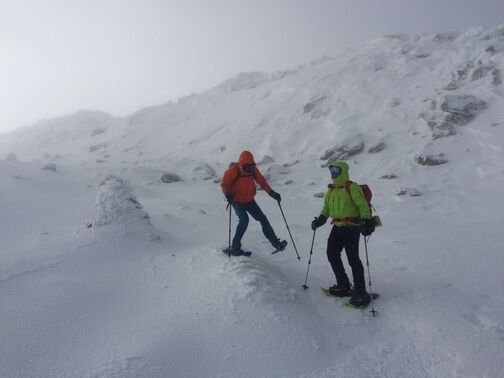 No one was going to do a map & compass reading in this high wind and brutal cold on Boott Spur. Because Murphy’s Law is a constant, and given that more complicated systems have more points of potential failure (you drop your phone off a cliff, your battery dies, you suddenly lose cell coverage, your smartphone GPS subscription runs out, etc.), maybe it is wise to carry a paper or synthetic fabric map (blows away in the wind, gets too soggy to read, a bear eats it, you were short on toilet paper) and GPS app when the hike you’re planning has a certain degree of risk (maybe practice those compass skills, too). How to evaluate risk? Risk is based on a set of variables that includes your physical ability, hiking-wisdom, geographic knowledge, preparedness, and the prevailing conditions of the hike itself. I have, for instance, been up Mount Monadnock so many times that I could probably find my way back down blindfolded through a blizzard. But evaluating risk is a catch-22: you get better at evaluating it the more you hike, which means you always have to be careful to not get in over your head. At the end of the day, the reality of today’s electronic culture can’t be dismissed by standing on the back of a chair with a map of the Adirondacks tattooed on your chest and admonishing hikers these days! nor can the practical economics of not having to buy paper maps and guidebooks whenever and wherever you happen to want to hike on the surface of the earth. As a rule of thumb, for shorter, less remote hikes in good conditions with a sufficient battery charge, and after verifying that your particular trails are in fact included in the GIS data your GPS application is using to create their maps (not always the case), bringing along a paper map (and compass) may be redundant (if a smartphone wasn’t useful for so many other things, one could make the reverse argument).  We made good use of GaiaGPS to locate and visit a variety of hidden ledges on our bushwhack up Eagle Cliff in Franconia Notch--nice spots which I've noticed many other hikers miss. As for what app you should carry on your phone, if you are a dedicated regular hiker and not working on a shoestring budget, it might make sense to have several providing they offer contrasting advantages. If you’re working on a tighter budget or if you hike less frequently, one may suffice. An app like GaiaGPS is a good, all-around, general-purpose app that is going to give you very good to excellent accuracy wherever you go on this fine earth. A higher Gaia subscription level will give you so many different map options that you won’t know what to do with them all. If you are planning on hiking in a specific geography for an extended period of time (a long hike on the PCT, or you spend a lot of time hiking in a nearby national forest), an app like FarOut or Avenza will allow you to purchase a highly detailed map of your stomping ground at a very reasonable price. If you are new to hiking and are just looking for some light to moderate hikes in not-so-remote places (with the possibility of branching out later), Alltrails can be a very good resource because it offers a multitude of suggested hikes that others have done before with route descriptions and user-community reviews.  Another GPS-assist off the beaten path in the White Mountains. THE VALUE IN GETTING LOST One of my favorite pieces of literature is William Faulkner’s The Bear. In it, the protagonist, a teenager and budding hunter growing up in rural Mississippi in the early 1900s, decides to track down an enormous, legendary black bear that has raided chicken coops and corn cribs for decades but has never been caught. When he first sets out to find the bear, he brings all his backcountry hunting and survival gear with him, but he catches only the faintest trace of the bear. Over time he comes to understand that his gear is an obstacle to his greater understanding of how to track down such an elusive animal. It’s only by entering the wilderness without props (he even leaves his hiking stick behind) that he finally develops the tracking skill to succeed.* The most profound learning occurs when we’re in a challenging spot (but hopefully not a life-threatening one). Nothing will teach you to read a map and parse a trail better than misreading one and having to painfully backtrack several miles uphill in the pouring rain to get where you’re going. Nothing will teach you how to read the natural landscape better than losing your map and having to find your way out through subtle cues that you may have sensed but never engaged during your map-dependent hikes. Fumbling with your GPS app is not unlike fumbling with a map and compass: if it doesn’t kill you or discourage you from ever hiking again, it’ll boost your learning. Of course we ought not to be so reckless than we endanger ourselves and others, but we ought not to be so risk-adverse that we stunt our learning. Sometimes that’s a fine line to walk. Like the protagonist in The Bear, the highest state of geographic zen a hiker can ever achieve is to learn how to tell direction and weather by natural cue (no maps or instruments), how to survive and adapt with a minimum of gear (anyone heard of Grandma Gatewood?), how to know the land through an intuitive map imprinted in the brain (via repeated familiarization and/or wise extrapolation of common geographic patterns), and --lastly-- to use technology (from the map right up to the device) to supplement, not replace, that wisdom. But that takes time, practice—and getting lost. Here’s to getting lost and found. --Paul-William *There's been some banter about whether or not using a GPS device causes part of our brains to shrink. Although the jury's still out on that one, it it is true, I cannot help but wonder if our brains started shrinking when human beings got used to using maps and compasses instead of having to parse distance and location through cro-magnon brain power and memory alone.
If you are not already familiar with it, the practice of Gridding involves obsessively hiking each and every peak in an elevation-based list of high peaks once in every month of the year. You keep track of them in spreadsheet fashion, thus the term "grid." Some people even grid the same peak list multiple times. The original “Grid” got its start with the New Hampshire 4,000 Footers list—to grid the 48 summits requires summiting 576 times. The practice of gridding has since metastasized to many other peak bagging lists. If Gridding sounds like fun to you, read no further. But if the idea of Gridding makes you pine for that naked January hike, but you fear you’ll succumb via peer pressure or a sudden midlife crisis, here are 9 compelling reasons to not become another Gridiot—and a bunch of fun hiking goals you can adopt instead. 1. When you die, you’re going to be dead a long time. Do you really want to spend precious hours of your short life hiking Mount Waumbek 12 times? The Grid may not be entirely boring (i.e. not in the same general category as watching C-Span or a film of granite slowly eroding) but the world is full of new, spectacular places to visit and things to experience. If you’re thinking of spending your summer gridding vs. taking that trip to the Grand Canyon, or spending more time with your grandchildren, well. . . 2. If everyone is doing it, it’s no longer cool. A few years ago, people were dumping buckets of ice water over their heads and taking photos of themselves planking in strange and precarious places (never mind bathroom mirror selfies). There are still people who will get sucked into doing the Macarena and Chicken Dance at weddings without any shame or sense of cliché. You don’t want to be one of those people. 3. Your regular hiking friends are going to get bored with you. “What are you doing this weekend?” “Ah, um, I’m hiking Mount Cabot. Want to come?” “Shit no. I just did that with you a couple weeks ago. Want to do something different with me this time?” “Oh no, that was September, I need it for my October Grid. . .and my November Grid. . .and. . .” “Well, I guess I’ll see you in a few years.” 4. All your social media posts read exactly the same. You were already a little boring when the only thing you posted on social media were hiking updates. Now all you do is post hiking updates about the same peaks over and over again. Zzzzzzzz. . . 5. There is a 5th dimension, beyond that which is known to man, a world in which trailhead parking lots are always full, and the waiting line for the summit photo stretches halfway down the mountain. . . . a world that might be called “The Gridiot Zone.” High profile list peaks are already overcrowded. Parking spaces and elbow room on the trails is in short supply. If everyone were to decide they wanted to grid. . . even a 10% increase in gridding would be too much horror for our puny minds to imagine. And do you really want to be the jerk that deprives a family with young kids of their parking spot and opportunity to do their first summit of Mount Jefferson—just so you can selfishly hike it for the umpteenth time? 6. All your hiking photos look exactly the same. Zzzzzzzzzz. . . 7. Why be a monkey. If you hiked the White Mountain 48 or the Adirondack 46 with a monkey and an organ grinder in tow, at least you’d be original. 8. There are nearby places far more spectacular than some of the peaks on the typical grid list. Percy Peaks vs. Cabot. Indian Head vs. Blake. Tumbledown vs. Redington. More than a few of the alternatives are even tougher hikes than the list hikes. Really, if you’re going to grid a list, grid a list of spectacular summits, not a list based on something as unimaginative as an arbitrary elevation cutoff. 9. If you need something like the Grid as an excuse to hike, what do you need as an excuse to live? HAPPY ALTERNATIVES TO GRIDDING:
the New England Trail (CT, MA, 215mi with an unofficial extension from the state line to Mt. Monadnock in NH), Long Path (NY, 357mi), Finger Lakes Trail (NY, 580mi), Northville-Lake Placid Trail (NY, 138mi), Taconic Trail System (CT/NY/MA/VT; 2 trails, 58mi), Midstate Trail (MA, 92mi), Warner Trail (MA, 30mi), Bay Circuit Trail (MA, 200mi), Wapack Trail (MA, NH, 21mi), Monadnock-Sunapee Greenway (NH, 48mi), Sunapee-Ragged-Kearsarge Greenway (NH, 75mi), Cohos Trail (NH, 170mi), North-South Trail (RI, 77mi), Hills-to-the-Sea Trail (ME, 47mi), Sebago to the Sea Trail (ME, 28mi), and Georges Highland Path (ME, 60mi). There are completion patches and certificates for many of these shorter long-distance trails.  Southern Maine's Pleasant Mountain
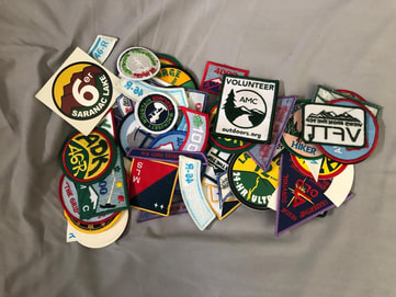 Michael Blair's impressive patch collection (which does include a Grid patch)
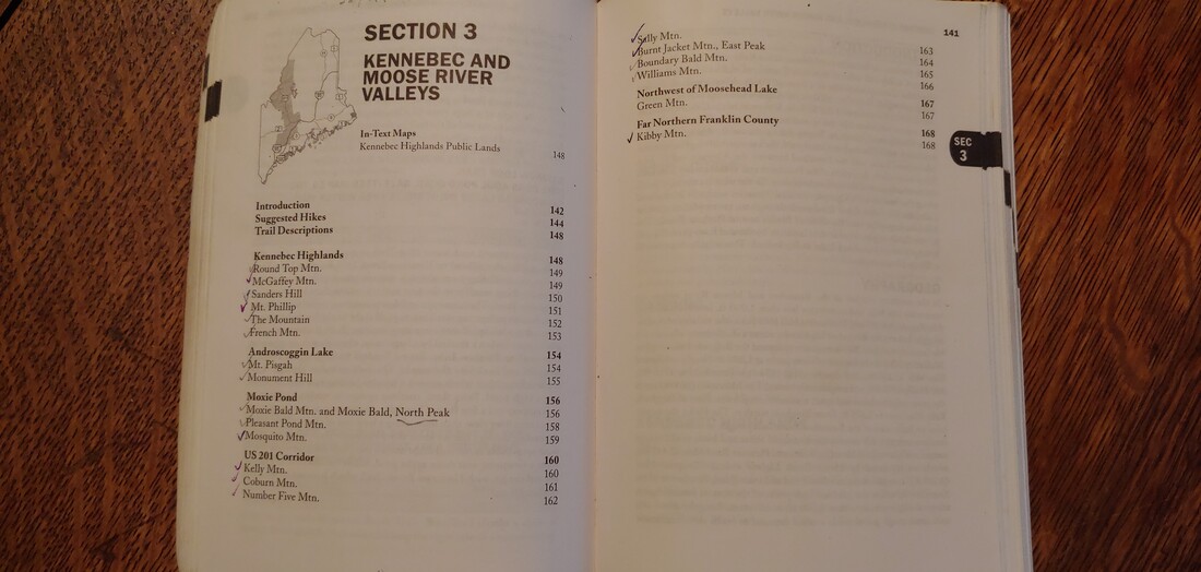 Checking off hiked peaks in the AMC Maine Mountain Guide
 Maine's Tumbledown Mountain--as tough and stunning as many of the better Grid-list peaks. All in good fun folks--hike whatever makes your feet sing. --Paul-William 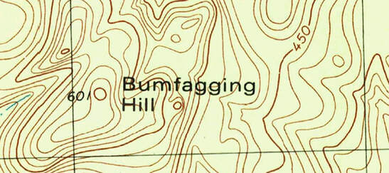 New Hampshire's Bumfagging Hill I collect hiking maps and topographic maps. I love looking at them and imagining how the contour lines play out in the physical landscape. As an “off-the-beaten-path” hiker and land conservation professional, this interest serves me well: just a glance at a map will tell me a lot about the terrain I’m planning on visiting. Because I hike and look at maps a lot, I can’t help but wonder about place-names, particularly the designated names of mountains and hills. Which brings me to Bumfagging. Bumfagging Hill, that is—located in Barrington, New Hampshire, elevation 601 feet above sea level.
Such a bureaucracy exists because, if we cannot all agree that a place is called this and not that, then we are going to have a great deal of trouble sharing information and making consistent maps (lacking the affinity of machines who need only numeric coordinates to find meaning in geography). The most important consideration of the USBGN in accepting a place name is demonstrated local use and acceptance of the name. It is the job of the USBGN to determine which local use names are legitimate and which are not. All else being equal, USBGN has tended to favor one name over another based on the relative amount of use: two names enter, one name leaves (but USBGN will preserve historic names that have fallen out of use as “variants”). There are other rules: no features named after living people or commercial enterprises; no derogatory names; and no commemorative names for people who had no relation to the geographic feature. Officially recognized names find their way onto USGS topographic maps and into USGS databases, and from those do Google, Open Street Map (OSM), Rand-McNally, Texico, National Geographic, Garmin, DeLorme and all others rely when making maps and presenting GIS data to the public (OSM does take some liberties there with regard to making up names for topographic features that don’t have official names).  The New Hampshire legislature tried and failed to rename Mt. Clay (foreground; photo: Sue Lin). Once a name becomes official, it’s not necessarily set in stone—it can be changed if the name falls out of use and another name eclipses it. In some cases the USGBN has rejected government designated names—New Hampshire’s Mount Clay (a sub-peak of Mount Washington) was officially (and oddly) designated by the New Hampshire legislature “Mount Reagan” to elevate Ronald Reagan amongst the godhood of the Founding Fathers venerated in the Presidential Range. But because the USDA-USFS (who owns the mountain in the public trust as National Forest) refused to recognize “Mount Reagan”, because Regan had no real connection to the White Mountains, and because local acceptance of the term was less than tepid, The Gipper will have to go elsewhere for his legacy (stick with airports, old man). 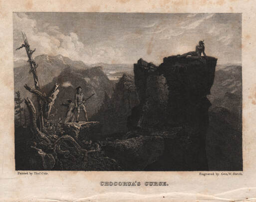 Chororua curses the encroaching whites before he leaps to his death. MASSA-ADCHU-ES-ET, CHOCORUA, TECUMSEH, and POKE-O-MOONSHINE: SACRED NAMES, APPROPRIATION, WHITEWASHING, AND B.S. Some “local use” place names originated prior to the arrival of Europeans in North America. For Native Americans, naming places was useful in communicating geography and cultural relevance. Places were often named for what they provided (Androscoggin = “place where fish are dried”) or for some physical characteristic (Sebago= “big lake”), and less commonly for a deity or spirit (“Pamola”). Since Native Americans were typically sharing this kind of information on a much smaller scale of geographic reference and awareness than we live today, using the term “Sebago” and “Androscoggin” were meaningful if you lived anywhere in the vicinity of southern Maine where there existed one really “big” lake and a lot of noticeably smaller lakes, or if the best place to dry fish was along a certain river that you happened to live near. Europeans often had ulterior motives in re-using or obliterating native names: to claim the name of a thing or rename it subverts someone else’s association with a thing. When Europeans appropriated Native American places names, they also often butchered the syntax and meaning, or applied them to too broad a geography. For instance, the word Massachusetts is derived from the Algonquin-language phrase “Massa-adchu-es-et” which means “Great Hill”—the sacred landform central to the homeland of the Massachuseuk tribe. The hill is now known as Great Blue Hill of the famed Blue Hills (located near Boston) while the derived spelling Massachusetts has been applied to the entire state. Likewise, Vermont’s Mount Ascutney is a phonetic meandering of the Abenaki Cas-Cad-Nac, meaning “mountain of the rocky summit,” while southwest New Hampshire’s Mount Wantastiquet is closer to the original Wantastekw, which is the Native American name for the Vermont’s West River (which joins the Connecticut River at the mountain’s base) and translates as “lost river, i.e. river on which it is easy to get lost or easy to lose the right trail.” The Uncanoonuc Mountains, two robust, rounded summits just south of Concord, New Hampshire are supposedly a tongue-twisting of the Massachuseuk term kuncannowet for a woman’s breasts (and now you, too, will forever see them that way). New Hampshire’s Wapack Range is a recent portmanteau of two summits with Native American names: Mount Watatic and Pack Monadnock.  Baxter State Park's Pamola Peak, named for a Native American storm spirit. There are still quite a few mountains and hills in the Northeast bearing true Native American names. Mount Katahdin (ME), Pamola Peak (ME), Mount Agamenticus (ME), Lunksoos Mountain (ME), Mount Wachusett (MA), Pawtuckaway (NH), Mount Waumbek (NH), Mount Monadnock (NH), and Pack Monadnock (NH; pack=”little”) seem to have got their names directly from Native Americans, while Mount Kineo (ME), Schoodic Mountain (ME), Adirondack Mountains (NY), Magalloway Mountain (NH), Mount Pemigiwassett (NH), Shawangunk Ridge (NY), Hoosac Range (MA), Yokun Ridge (MA), and Chickataubut Hill (MA) got their names via white people who associated the topographic feature with certain Native American tribes, individuals, or native-named non-mountainous geographic or naturel features. For instance, Algonquin Mountain and Iroquois Mountain in the Adirondacks are named for high peaks near territorial boundaries of those competing tribes—though Native Americans might have had other names for the peaks. One of my personal favorites is Vermont's Moosilamoo Mountain which means "the moose departs"--what a great visual, but it's not clear Native Americans really applied it to the entire mountain or were just pointing out a moose trail to some misunderstanding white folk.
volcanic cliffs that extend from the Holyoke Range in MA south through CT to Long Island Sound at New Haven’s West Rock Ridge). Perhaps the most famous association of an individual Native American to a summit is Mount Chocorua in New Hampshire, the entire mountain a eulogy to cross-cultural dissonance and tragedy. In some cases, the Native American name was abandoned with the meaning partially or wholly retained in English. New Hampshire’s White Mountains were known by Native Americans as Woban-aden-ok: “place of the high white or crystal/mica mountains.” The Sleeping Giant in Connecticut, a volcanic ridge which appears exactly the way it sounds when viewed from a distance, was the mischievous giant and god-spirit Hobbomock, petrified and forced to sleep off his bad behavior after diverting the course of the Connecticut River. Interestingly, Hobbomock is also credited with killing a giant beaver which was terrorizing local tribes in the Connecticut River valley of Massachusetts—you can still see the shape of the petrified giant beaver in the profile of Pocumtuck Ridge (the name of a Native American tribe) and Mount Sugarloaf in that area (curiously, giant beavers with teeth as long as bananas did briefly co-exist with early Native Americans in New England). 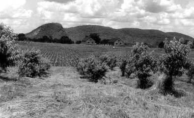 Connecticut's Sleeping Giant Hobbomock Other Native American names were applied later by white folk in a fit of historic whitewashing and romatasizing of Native-American and white interactions (sometimes with gross geographic liberties). Examples include Pemetic Mountain (ME), Penobscot Mountain (ME), Mount Norumbega (ME), Mount Norwottuck (MA), Mount Nonotuck (MA), Mount Weetamoo (NH), Mount Kancamagus (NH), Mount Passaconaway (NH), Wonalancet Mountain (NH), and probably Mount Greylock (MA, for the Missisquoi chief Wawanotewat, also known as “Grey Lock”). Mount Osceola (NH) is named for a Florida Seminole chief. Mount Tecumseh (NH) is named after the famous Midwest Shawnee leader and war chief who never set foot in the northeast. Someone (no one seems to be sure who) apparently thought it would be a nice gesture to name a mountain in New Hampshire for Tecumseh after his people were rubbed from the face of Ohio.
In some cases the actual connection to Native Americans and Native American usage is frivolous, misused, or questionable. Pocomoonshine or Poke-O-Moonshine is the name of two mountains, one in the Adirondacks and one in Maine (along with a number of ridiculously named summer camps)—a distortion of an Algonquin phrase for something other than bootleg liquor. Legend has it that Quaggy Joe, a small mountain in Aroostook County, Maine (and a state park) got its name from a Native American named “Joe” who was found buried in a tomb near the bog (quagmire= quaggy) at its base. No evidence of any such tomb exists and the name may instead originate from the Maliseet greeting Quaquajo “where are you going?” New Hampshire’s Squam Range gets its name from the lake it its foot, but the original native name of the lake was Keeseenunknipee (“goose lake in the highlands"). For the heck of it, New Hampshirites renamed it another Abenaki name, Asquam (“water”), which was later shortened for convenience to Squam. The Mahoosic Mountains (ME and NH) might be derived from a native term for “pinnacle” or more menacingly (and more fun) “home of the hungry animals”—no one is sure. Perhaps the saddest designation may be the generic Indian (Hill, Mountain, etc.)—where only the vaguest hint Native American heritage remains. Most recently there has been a national trend to re-name mountains (under the USBGN “no derogatory use” principle) that contain the Native American term Squaw, a word with a complicated history which includes derogatory references to native women. For instance, in Maine Big Squaw Mountain and Squaw’s Bosom were officially changed to Big Moose and Moose Bosum. The fact that even Native Americans don’t all agree that “squaw” is a derogatory term ( nevermind that "Moose Bosum" conjures anatomic features straight out of a psychedelic romp through a Hieronymous Bosch painting) suggests that if we’re going to extinguish native-language place-names, then out of respect for Native Americans we at least ought to ask them (in the case of "squaw" ask Native American women) what place-name they’d prefer instead. MOUNTAINS BY IMAGINATION AND PROSPERITY (OR LACK THEREOF) The majority of mountains and hills in the northeast United States were named or renamed by Europeans, rubbing out whatever native place names and meaning might have existed. Like Native Americans, Europeans also frequently named places for how they appeared or what they offered. Probably the most common appearance-themed name for mountains and hills in the northeast is Bald (inc. Baldpate, Baldface, Baldhead, Baldy, Bare, Barren) with over 175 occurrences. Likewise generic are many instances of peaks named Rocky, Stone, Bluff, Cliff, Pinnacle, Peaked, and Round. A local variant of Rocky, particularly common in the Berkshires, is Cobble (ex. Cheshire Cobble and Tyringham Cobble along the A.T., among others) which alludes to cobblestones. Ragged (20 summits) is a frequent name for a mountain or hill with a convoluted ridgeline; Puzzle Mountain (ME) may be the result of a similar observation. Doublehead, Doubletop, Brothers, Two Top, and Twin, are common across the northeast for mountains with two summits, while New Hampshire’s Tripyramid, New York’s Three Brothers, and Connecticut’s Trimountain give praise to peaks of three. Many people are surprised to discover how many Owl’s Heads (24 summits), Saddlebacks (15), Haystacks (27), and Sugarloafs (45) we have. Mountains with rounded tops and facing cliffs from which tufts of trees emerged looked like the heads of owls, and smoothly rounded hills or granite domes with steep sides reminded 19th century Americans of the conical loaf-like form which sugar was purchased and sold back in the day (in Quebec such hills are similarly called Pain de Sucre). Hills or mountains with heap-like shapes looked like haystacks; those with smooth, sloping sags between peaks looked like horse saddles. Also descriptive but less common we have Sawtooth (NY, CT), Knife Edge (ME), and Table (NY, NH). Maine’s well-known 4K Saddleback Mountain has a peak named The Horn, sharpy located along the ridge where a saddle horn ought to be on a saddle. The Beck-horn in the Dix Range of NY reminded guide Old Mountain Phelps of the horn on a blacksmith’s anvil (a beckhorn). Other Horns may have reminded folk of animal horns. Curiously, people saw Sugarloafs everywhere but only one mountain got named Breadloaf (VT)—despite the timelessness of bread to humanity. We have mountains named Fort, Quarry, Monastery, Tower, and Lookout for the structures that do or did stand on them, or for their resemblance to those structures. Lots of mountains were named for their color as they appeared from a distance. Not very Imaginative since most mountains and hills look either Black or (less commonly) Blue at distance; there are dozens of these scattered across the northeast states with Black being among the most common name for a mountain (over 50 references; add Black Cat, Black Bear, etc. and the count approaches 75). Quite a few White (Whitecap, Whiteface, White Cliff, etc), Red, and Green mountains have made the cut. Whiteface usually indicates a big cliff; there are three such mountains (all with trails and cliffs) in New Hampshire and one in New York (one of the 46ers) while those named Whitecap (and Snow) were probably named for their abrupt visibility from a distance in the spring or fall after a dusting of snow. Mountains named Blackcap, Black Snout, or Blackhead (and perhaps Old Speck) probably refer to the dark ring of coniferous forests that crown the summits of those peaks. We also have a Streaked Mountain, a couple Speckled Mountains, and a Rainbow Mountain in Maine where folks couldn’t decide on just one color. The most imaginative use of color is prettily-named Azure Mountain in the Adirondacks. Some mountains were named for mineral resources: we have several Silver (NH, VT, NY, CT), Crystal (NH, ME), Garnet (NH, MA), and one Zircon Mountain (ME); numerous Iron and Lead (for either elemental lead or graphite), and several peaks generically named Mine or Ore. Although we have several summits named Diamond, diamonds are not generally found in the northeast United States and the naming may originate from overly hopeful tales about quartz crystals mistaken for diamonds (as was the case with NH’s Diamond Peaks and RI’s Diamond Hill). In western Massachusetts, Diamond Match Ridge probably refers to the Diamond Match Company, at one time a major New England timber landowner and manufacturer of matchsticks. Auburn, Maine’s Mount Apatite has a substantial old mine containing apatite and many other minerals; the mines are now within a conservation area with hiking trails. Native Americans mined stone for tools on Mount Jasper in Berlin, New Hampshire for which it is now named. Plumbago is another name for graphite, and we have a mountain in the Grafton Notch area of Maine area by the same name. Potash Mountain (NH) alludes to potassium (the shape of the mountain supposedly looks like potash pot--used to derive potassium from burning). In New Hampshire, Isinglass Mountain is named for the pegmatite mines below the peak (the famous Ruggles Mine) which contains a lot of mica, otherwise known as Isinglass. (I should mention that Tinmouth Mountain in Vermont isn’t a pun on orthodontics—it’s a derivation of a traditional Scottish culture name and has nothing to do with tin). There are more Blueberry Mountains (hills, ledges, etc.) in the northeast than you can shake a stick at—many of them actually good berrypicking—but not as many strawberry peaks and none named raspberry (why the hell not? I ask) but we do have a few Cranberries. Trees, too, claim a fair share of peaks. Spruce, Fir (inc. Balsam), Oak, Pine, Poplar, Birch, Beech, Chestnut, and Maple are commonly applied to mountains and hills. Singepole Mountain (ME) probably gets its name for the condition of timber on the mountain following a forest fire. Of the same ilk, we have many Burnt Mountains/Hills and including two creatively characterized Burnt Jackets in Maine (both have trails). Maine has an Onion Mountain--a remote and trailless 3K peak-- one of the few peaks in the northeast named for a root vegetable. Other root names include Potato, Bloodroot, and Gentian--the latter a flavorful wild root and former secret ingredient of Moxie, the classic Maine carbonated beverage and the name of several mountains in the state. “Moxie” is an Mainer-adopted Abenaki term for darkly colored water; it is widely applied to hydrologic features in northern Maine. Then there are peaks named for critters. Certain animal names for peaks presumably came about by appearance (ex. Elephant Cliff in New Hampshire which really does look elephantine) but in many cases it’s a mystery why the name of a common animal (or tree) was applied so specifically (the greater density of squirrels and mice would seem to mean that there should be lots of peaks named for them—but there are only a couple peaks named for small varmints). Including the previously mentioned anatomy of owls we have several whole Owls. Deer (inc. Buck), Bear, Eagle, and Moose are also fairly common but we also have several of Crow, Bird, Raven, Cow, Bull, Elephant, Horse, Trout, Hawk, Snake, Camel, Loon, and Goat. We have Wolves, Panthers (inc. Wildcat, Catamount), and Rattlesnakes, sadly located in places they were extirpated from. Other animal species are named in summits with less frequency. Caribou, for which we have three peaks named in Maine, were once plentiful in northern New England but were extirpated in the 1800s— despite several later attempts to re-introduce them to Baxter State Park (the latest in the 1990s). Our six summits named Black Cat (ME, NY, NH) may be simple dark color references (i.e. Black Mountain) but could refer to legends of melanistic cougars. Blackpoll Mountain in the Berkshires is named for a warbler species. Hedgehog/Porcupine are very common (69 summits) and probably got their names for evergreen saplings poking like quills out of the backs of small, humped peaks. Mosquito Mountain in Maine, despite the pestilential name, is a lovely hike and one of the few honoring invertebrates (others include Caterpillar, Beehive, Beetle, Bug, Bugmouth, and Lobster). Most famously, the name Couching Lion lives on in the USBGN as variant name for Vermont’s Camel’s Hump dating back to the 1600s (“couching” being a heraldic term for a lion in a certain pose). In the Ossipee Range of New Hampshire, Turtleback Mountain lives up to its name with octagonal box-turtle shell patterns in the stone at the domed summit, created by cooling volcanic material. In the Hudson Valley of New York, where the Dutch had an early presence, there are lots of places with Dutch names frequently including the term kill which means creek, from whence the Catskill Mountains get their name, possibly “cat’s creek” because of catamounts—cougars--which inhabited the area. There is also a peak in the Catskills called Bearpen—presumably meaning a place where bears were as plentiful as domestic (“penned”) stock. Famed Goose Eye in the Mahoosic Range of Maine is one of my favorites both in name and character; the name might be a butchering of “Goose High” but who cares—it’s fun. Then there are mountains that got their name in bland gestures of geography; we have multiples of North Mountain, South Mountain, East Mountain, and West Mountain (visualize a local pointing yonder and saying “beyond that thar west mountain . . . “). Similarly, we have several Sunsets and Sunrises, which more cleverly state direction. During a period of firetower construction in Maine in the early 1900s, several as-of-then unnamed peaks were designated with numbers in order to identify their place in the system of fire lookouts; there are still maintained trails leading to the tops of Numbers 4, 5, and 9 Mountains. Other peaks were lazily named for more generally known geographic features that they happened to be near: we have numerous summits named for the towns they are in, or the rivers, lakes, or swamps they are near; we have peaks named “Little” and "Middle" to distinguish them from other peaks nearby (with several glaring elevation mistakes, for instance Big Spruce and the adjacent but higher Little Spruce in the 100 Mile Wilderness of Maine). As the ultimate act of uncreative nomenclature, there is even a mountain in Maine simply called The Mountain. People from that area did not get out often. I’ve always been particularly enamored with mountains named for the furious elements: Lightning Ledge (ME), Thunder Hill (NH), Hurricane Mountain/Hill (NY, NH), Saddleback Wind (ME), Galehead (NH), Firescrew (NH), Storm King (NY), and Mount Aeolus (VT). Also among my favorite names for mountains were those nominated by old-time guides, lumbermen, and hoteliers, creatively or with a grand sense of humor. When famed Adirondacks guide (and likely perv) Orson “Old Mountain” Phelps insisted an ADK high peak retain the local name Nippletop, everyone knew why—and the name stuck despite several attempts to abolish it. At the top of my list are Breakneck Ridge (NY), Ampersand (NY), Wallface (NY), Noonmark (NY), Pitchoff (NY), Scarface (NY), Skylight (NY), Glassface Ledge (ME), Old Speck (ME), Goose Eye (ME), Flying Mountain (ME), Flying Moose Mountain (ME), The Bubbles (ME), Chairback (ME), Ragged Jack (ME), Puzzle Mountain (ME), Rump Mountain (ME), John B. Mountain (ME), Shatterack/Shatterock (MA, VT), Tumbledown (NH and ME, inc. Tumbledown Dick and Tumble Dick), Imp (NH), Black Snout (NH), Thumb Mountain (NH), Cathedral Ledge (NH), Mount Isolation (NH), Crotched Mountain (NH), Bacon Ledge (NH—who doesn’t like bacon?), Mount Deception (NH), Fool Killer (NH), the Hanging Hills (CT), Barn Door Hills (CT), Cathole Mountain (CT), Widow White’s Peak (MA), Gobble Mountain (MA), Poverty Mountain (ME, MA), Equinox Mountain (VT), Romance Mountain (VT), Mount Horrid (VT), Silent Cliff (VT), Grandpa Knob (VT), and the ubiquitous Mount Hunger (ME, NH, VT, NY and MA—lots of people must have starved in those states). In Connecticut, depressives can indoctrinate themselves on Misery Mountain (also peaks in MA, ME, NY), then properly proclaim their suffering by hiking Lamentation Mountain. The term Tumbledown probably alludes to significant rockfall, with the “Dick” added later for humor of one sort or another (possibly an allusion a common old-time pun on Oliver Cromwell’s son Richard’s fall from power in Britain). I’ll leave you to speculate the fun origins of the other peaks mentioned above. DEAD WHITE DUDES A gender-and-ethnic biased mountain of mountains, however, have names either drawn from European geography and culture or for dead white folk, mostly men. In the most innocuous form of the practice (in the days when people were really spread out), a single male-lineage household might be near enough to a peak that folk began to refer to the peak in association with the family name. For example, Smith Mountain (not uncommon) may have got its name because the Smith clan lived nearby. Similarly, we have several Shaker and Quaker summits in the northeast, named for their proximity to those religious communities. 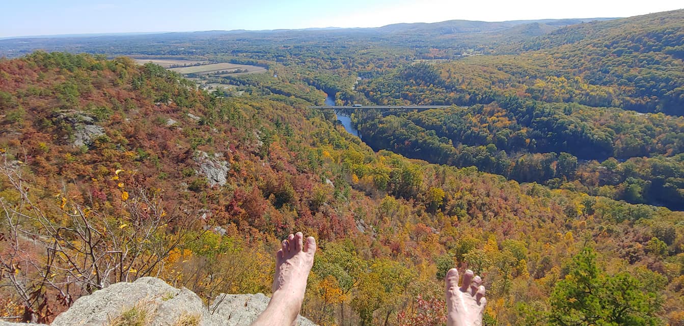 Biblical Mt. Tekoa looms over the Westfield River Valley (MA) Plenty of hills and mountains got their name from Old-World places that sounded pleasant and familiar to colonists, sometimes borrowed from town-names likewise conjured. Old World England place-names abound in the northeast United States along with lesser numbers of French, Dutch, Irish, German, and Scottish names, plenty of biblical names, and even names out of classic literature. In Vermont, Mount Aeolus is fittingly named for the Greek god of the wind. In New Hampshire’s Squam Range we have two facing mountains with names curiously associated with characters in Arthurian legend: Mount Percival (Sir Percival, the protagonist knight who found the Holy Grail) and Mount Morgan (Morgan le Fay, the antagonist sorceress of the Arthurian sagas). Mount Pisgah is the name of at least 25 mountains in the northeast and gets its name for a peak mentioned only briefly in the Old Testament, as does fierce-looking Mount Tekoa which dominates the eastern I-90 gateway to the Berkshires in Massachusetts. Abraham (also Abram) is honored in mountains in Maine and Vermont, and the holy Madonna in Vermont at the Green Mountain crest near Stowe. Perhaps the most common biblical honoree, though, is Satan, who was apparently the consummate hiker. Infernal summits and other geographic features are numerous; summits include Devil’s Den (ME, NH, NY), Devil’s Garden (MA), Devil’s Rock (MA), Devil’s Peak (MA), Devil’s Hill (VT), Devil’s Wall (ME), Devil’s Head (ME), and Devil’s Backbone (ME, NY). There is even a boulder on the Holyoke Range of Massachusetts named Devil’s Football. Presumably these places got their names because of their hatefully rough terrain. Curiously, there aren’t any peaks named “Heaven”, “Jesus”, or “God,” but the French influence in northern areas did result in a few saints squeezing through including St. Regis in NY, St. Catherine in VT, and one oblique Christ reference via St. Sauveur Mountain (Fr. "Holy Savior") in Maine’s Acadia National Park (cross the border into Quebec and every other hill is named for a saint). Lastly, there is a Holy Mount in the Berkshires, where Shakers congregated for rituals, but the list of halos is short overall. Folks did manage to think of quite a few mountains as at least Pleasant (over 30 summits) or as promising Prospect (over 50) if not holy.  The Mansfield Profile (Jared C. Benedict ) In terms of naming peaks for specific individuals, some were christened as a matter of colonial land appropriation for the English lord or financier who funded or supported a settlement, or the crown-designated governor. When residents of what is now Guilford, VT were required to set aside a portion of land in their community for the colonial governor, they happily surrendered the most inhospitable and worthless terrain they knew of and (in typical laconic Vermont humor that persists to this day) referred to it as Governor’s Mountain. Mount Mansfield, the high point of Vermont, is presumed to be named after a land grant by the same name (which was never incorporated as a town) which in turn is probably named in a fit of cronyism for the English magistrate Lord Mansfield who adjudicated in favor of expanding the territory of the same colonial governor who named the land grant “Mansfield” (that said, in a grand coincidence the mountain displays the distinct profile of a man’s face when viewed from the east with Forehead, Chin, Nose and Adams Apple on the map). 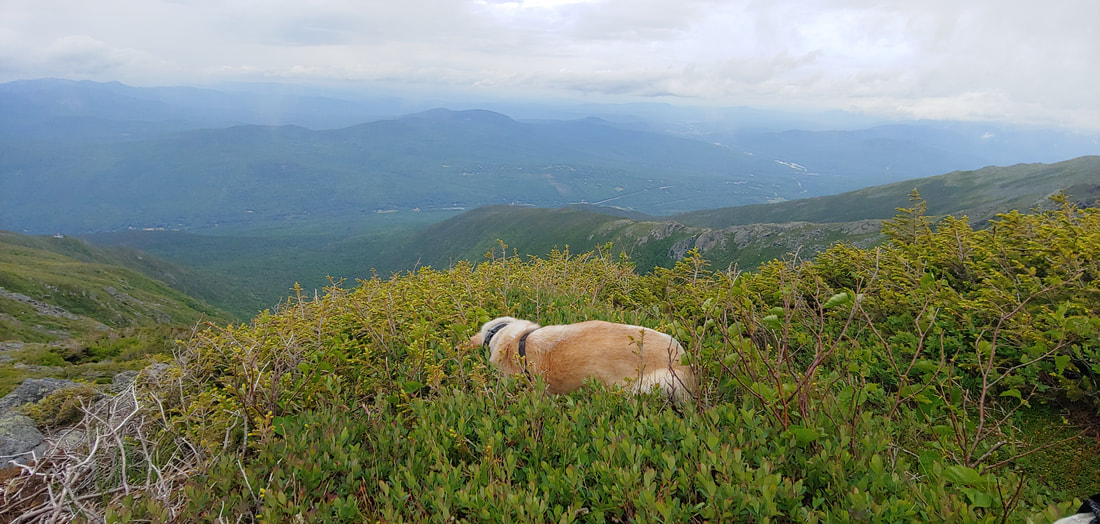 Crest of the Presidential Range And then there are the honors, some of them grand, some quaint, and some ludicrous, many of beautifying politicians and military officers. Dismissing both the native names (Agiocochook, Woban-aden-ok) and various local European names for the high peaks of the White Mountains, giddy early explorers, like bulls in China shops, took it upon themselves to declare the highest ground there for United States presidents and other political luminaries. It began with Mount Washington in 1784 (five years before Washington was even elected President let alone dead) and the rest fell like dominoes: Adams, Jefferson, Madison, Monroe, Pierce, Lincoln, and Garfield. Eisenhower was added in 1972 (Ike had no connection to New Hampshire’s mountains but you can thank and blame him for access to and overcrowding of the Whites through his work in creating the U.S. interstate highway system). Only Franklin Pierce, who was from New Hampshire, had any substantive connection to the White Mountains (George Washington did not sleep anywhere near Mount Washington). The French general Lafayette, who selflessly served America during the Revolutionary War, also got a high peak, while Benjamin Franklin, the scientist of the Founders, only deserved a sub-peak of Mt. Monroe. Mount Jackson is frequently mistaken as one of the peaks named for dead presidents, but in fact the mountain is named for an early New England geologist, not President Andrew Jackson. Vermont, not to be outdone, named themselves a few presidents in the Green Mountains: Roosevelt, Grant, Cleveland, and Wilson. For New York’s highest summit, the wonderful Native American name Tahawus (“Cloud-Splitter”—beat that!) was ignored in favor of Marcy, the New York governor who commissioned the first environmental survey of the Adirondacks and helped set the great Adirondack Park ball rolling. 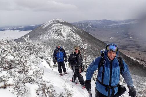 Avery Peak (background) in winter Other peaks of northeast were named for those people who explored, worked, wrote of, and researched the mountains: botanists, surveyors, geologists, guides, conservationists, timber barons, and writers. At least these geographic honors had some legitimacy: Mount Crawford in New Hampshire was named for the pioneer hotelier and hiking guide Ethan Allen Crawford who built what is now the oldest continuously maintained mountain hiking trail in the United States. Starr King, whose fun-sounding name graces a sub-peak of Mount Waumbek, was a popular orator, writer, and Universalist minister who wrote glowingly about the White Mountains. Famous New Hampshirite politician and orator Daniel Webster has several mountains in the state named for him. Mount Marshall of the Adirondacks is named for Bob Marshall, the great wilderness conservationist and the first person to hike to the summits of the ADK High Peaks (along with his brother and a family friend). There are several summits named for New England rural poet Robert Frost but none named for Henry David Thoreau (despite the fact he was an avid explorer of New England mountains himself) though he does get a lookout named for him on Mount Monadnock and USBGN recognizes Thoreau as a variant name of Katahdin’s South Peak (a crag on the Knife Edge). Ralph Waldo Emerson at least got a few hills named for him. Old Mountain Phelps got a mountain named after him in the Adirondacks, more for his colorful personality than his guide skills. Thankfully Maine’s highest mountain, the incomparable Katahdin, retained its storied native name, with just the peak designated in honor of the philanthropist and conservationist Percival Baxter. Baxter had a great sense of humility, and it is good to see that incorporated into his legacy, though he might have even balked at the liberty of naming the high point in his name. Similarly, the high peak of Maine’s Bigelow Mountain got named in honor of Appalachian Trail proponent Myron Avery while the common name was retained for the whole. The Green Mountain Club of Vermont managed to get several Long Trail luminaries recognized in peaks: Battell Mountain, Buchannon Mountain, and Domey’s Dome. 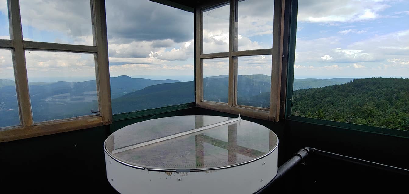 Inside the Hunter Mountain firetower (Catskills) Sometimes the designation is undeserved. Famed Ethan Allen (not to be confused with Ethan Allen Crawford) of Vermont’s guerilla Green Mountain Boys, despite being a celebrated war hero, was reputedly a real-estate swindling prick and egoist most of his life; one of the Green Mountains (and numerous other Vermont places), are named after him. Hunter Mountain, the highest peak of the Catskills gets its name from the town of Hunter, which in turn was a renaming of Edwardsville. Colonel Edwards of Edwardsville, who was a disliked tannery owner, was displaced either for an equally disliked former landlord of the area John Hunter, or alternately a town drunk also named John Hunter (possibly an intentional insult to Edwards). Roger’s Ledge in New Hampshire is named for colonial military strategist and genocidal maniac Robert Rogers who led a massacre of women and children in Quebec, burning churches and taking loot (someone really ought to rename that one--though the previous name for the ledge was even worse). 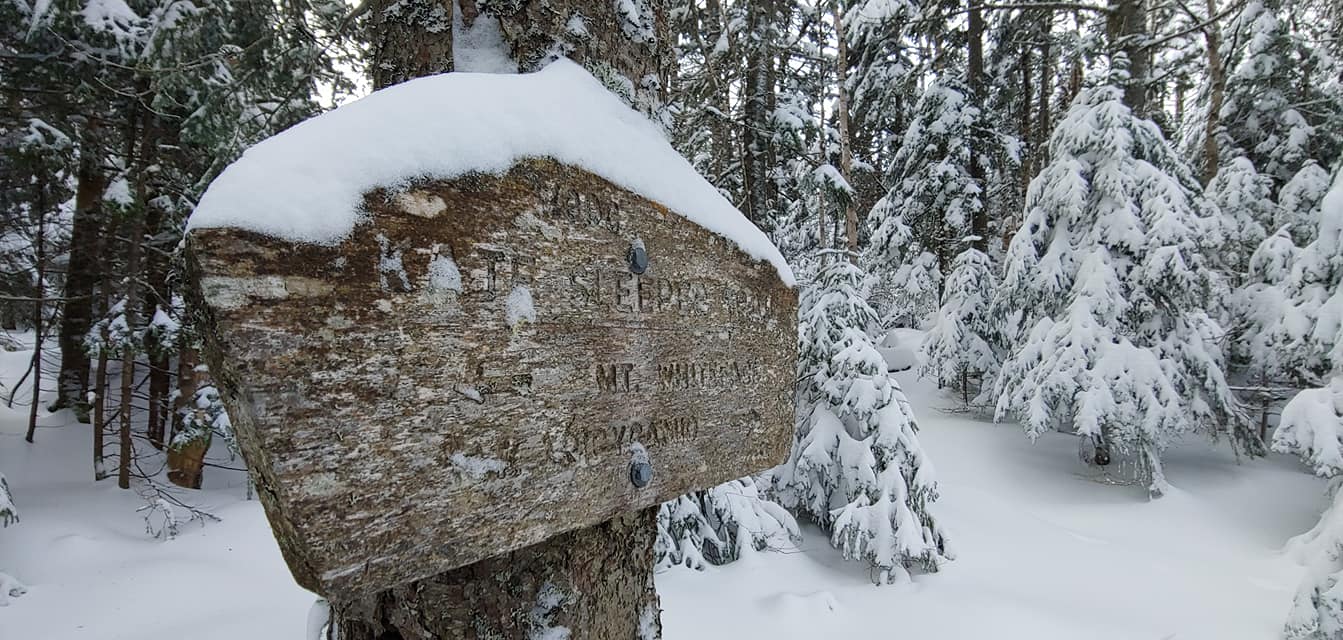 Sleeper Trail & The Sleepers (NH) are named for Kate Sleeper Sadly, there are very few summits named for women here in the Northeast. Trail builder and hotelier Kate Sleeper has two peaks (also a ridge and a trail), one of them a New England 100 Highest summit, named for her in New Hampshire. Interestingly, she is one of the few women that gets last name only mention, as is the norm for most peaks named for men (perhaps because women have typically taken on the surnames of men after marriage?). Mount Esther, of the Adirondacks 46, is named for adventurous Esther McComb who may have been the first person to climb the peak—solo, bushwhacking, for nothing but fun, and at the incredible age of 15 (they don’t make kids like they used to). Molly Stark, who has a Green Mountains peak in her name, is widely famous for being the wife of a Revolutionary War general and for doing wifely things, in particular being the silent brunt of her husband’s macho give-me-death-or-give-me-freedom war cry: “. . .or this night Molly Stark sleeps a widow!” Vermont’s 4K Mount Ellen may be named after a fictional character in a book by a male author. Mount Martha (NH), about 3,000 feet lower than lofty Mount Washington, is named for George Washington’s wife Martha. Mount Nancy (NH) is supposedly named for a young woman who died of hypothermia while searching for the lover who spurned her. Maiden Cliff in the Camden Hills of Maine is obliquely memorialized for a woman who also died tragically. No one knows who Mount Olga (VT) and Catherine Mountain (ME; possibly St. Catherine) are named for. Is that all, you ask? Yeah, female representation in topography is a gross injustice of nomenclature. There are a few more smaller hills and peaks also named after women, but the glut of bedrock is testosterone. Something needs to be done about that. Perhaps a shift is coming: in 2014 one of the high peaks of the Dix Range in the Adirondacks was officially named Grace Peak in honor of Grace Leach Hudowalski, a local Adirondacks folklorist, pioneer hiker, and mountain enthusiast (though I’m still curious why Grace and not Grace Leach Hudowalski). 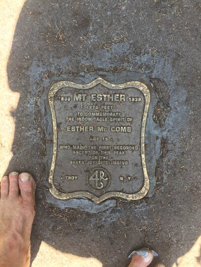 Dedication plaque to Esther McComb TO RENAME OR NOT TO RENAME Most recently, the current superintendent of Baxter State Park publicly suggested that Mount be removed from Katahdin in keeping with the Native American meaning "greatest mountain" (in effect Mount Katahdin really means "greatest mountain mountain"). His case for tweaking the name of Maine's highest summit to eliminate a redundancy in meaning is a good start: there are some really compelling reasons to have a wider conversation about renaming peaks, including equity and inclusion, rethinking names that no longer have any real meaning, and honoring people who have a relevant connection to the geography that will bear their name. (In response to the inevitable cries from traditionalists: it's hard to make a case for traditionalism when the tradition is undeserved or thoughtless). For instance, re-examining Native American legacy in places names puts society squarely in the path of reexamining the long history of broken treaties and genocide perpetrated upon Native Americans by colonials and their heirs. At least we ought do better than the drunken party of surveyors who self-centeredly christened the highest peaks of New England in the name of a bunch of dead presidents that had never even visited the White Mountains. Surely “Cloud Splitter” is a better name for the highest peak in New York than honoring a mediocre, forgotten state governor. Surely we don’t need 45 summits named Sugarloaf. Surely women are no less deserving than men of the honor of having geographic features named for them. 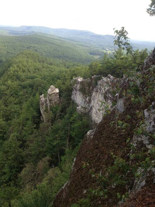 The Devil's Pulpit on Monument Mountain in the Berkshires. Satan really got around. On the other hand, there’s something to be said for preserving some of the nomenclature of weirdness we’ve inherited here in the northeast. In Vermont there are a quadro of intriguing mountains in the west-central part of the state curiously tagged The Gallop, The Pattern, The Purchase, and The Scallop--it’s anyone’s guess why, and that kind of quirkiness might mean more for our collective mountain culture than any new name we could conjure up. And having a bunch of summits named in honor of Satan is unavoidably humorous and pokes good fun at the most ridiculous aspects of the northeast’s puritanical past (if we cannot laugh at our traditions, there’s really no hope for our species at all). 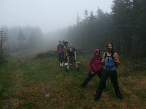 HIkers straddle the U.S./Canada boundary enroute to the so-called "Boundary Peak" If we do rename summits, we ought to avoid repeating the follies of past naming practices as they might impose themselves on us through our new technology and culture. For instance, where peaks lack names, peak baggers often apply bland, location-based names, causing those names to stick in the public consciousness: of the increasingly popular New England 100 Highest hiking list, we have the awkward “Peak Above the Nubble” (which is like saying "the peak above the peak") and the redundant “Boundary Peak” (one of a whole string of peaks in Maine with summits directly on the US-Canada border). Worse, the widely available database Open Street Map (OSM) routinely foists some truly heinous name choices upon us through its penchant for automatically naming unnamed summits for pretty much anything that is near them—and their data is disseminated through popular GPS apps worldwide. Too, crowdsource data like those promulgated through OSM are sometimes subject to malicious or vain tweaking—for instance I am aware of one 3K peak in Maine that I’m pretty sure a certain living hiker (or one of the hiker’s friends), named after himself through OSM nutfuckery (and if we keep taking the OSM name for granted eventually it will fall into USBGN "local use"). When we name, let us do so with good intention: be it in tradition, in descriptiveness, in wonder, in humor, or in honor. Our enduring summits—to the extent that we can be so silly to imagine they belong to us—deserve better from us than a Bumfagging.* *The term “fagging” is probably related to the practice of hazing that occurred in English schools circa the 19th century (occasionally including associated sexual exploitation and assault) where underclassmen were forced to run errands and carry baggage for upperclassmen (maybe itself derived from the older meaning of the word fag= sticks bundled in order to carry them from one place to another). The word “bum” has a number of meanings (buttocks, a homeless person, a lazy person, or a “of poor quality, or wrong”); in this case, combined with fagging, it could mean doing a real poor job of serving another person. Geographically: a useless hill. |
TOPICS
All
Humor (The Parsnip)

|
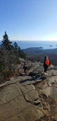
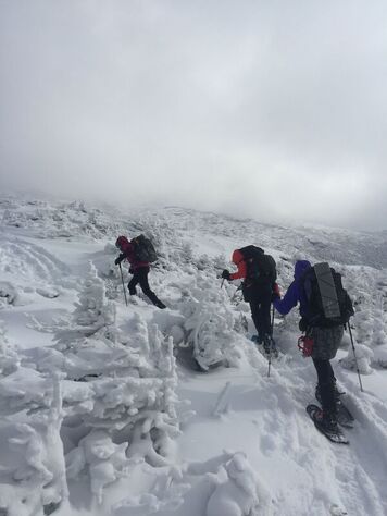
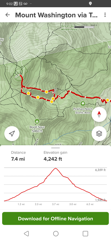
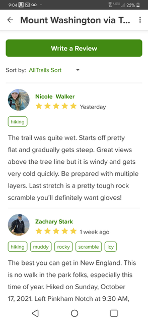
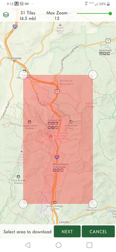

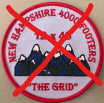
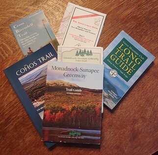
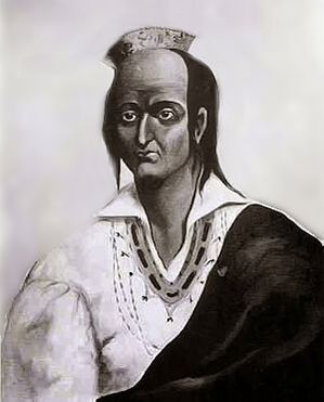
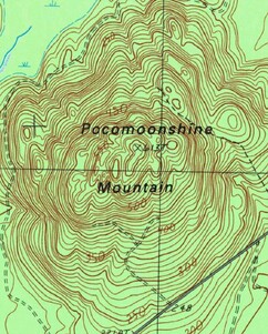
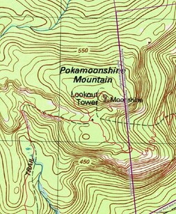
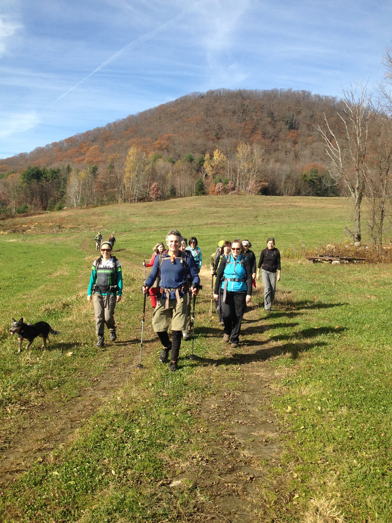
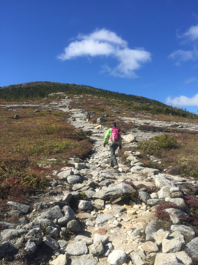
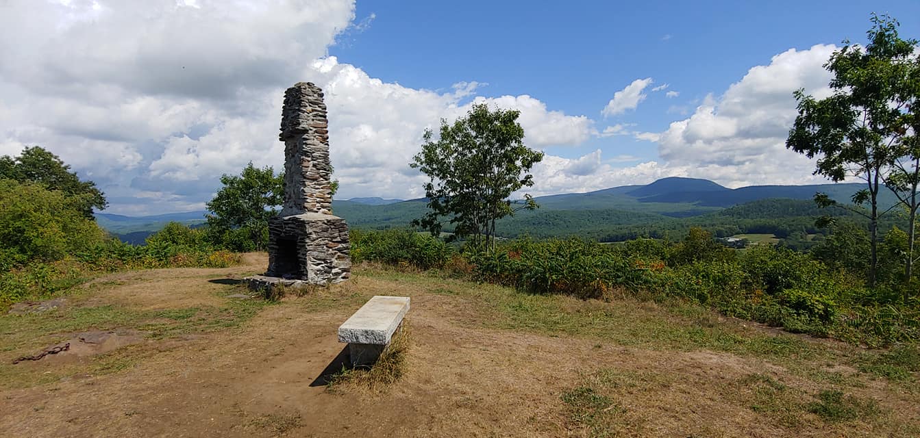
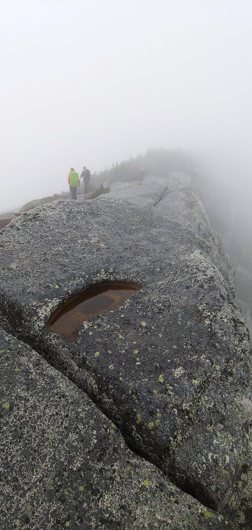

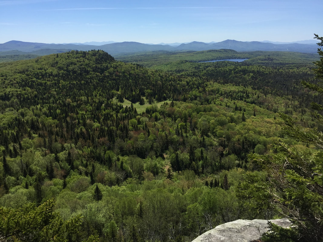
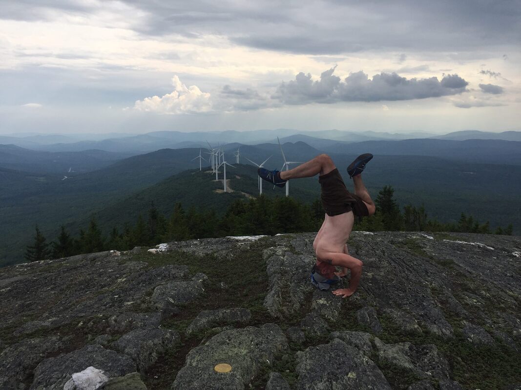

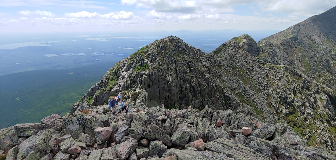
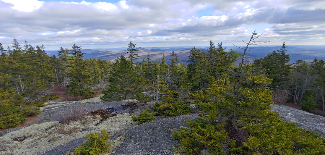
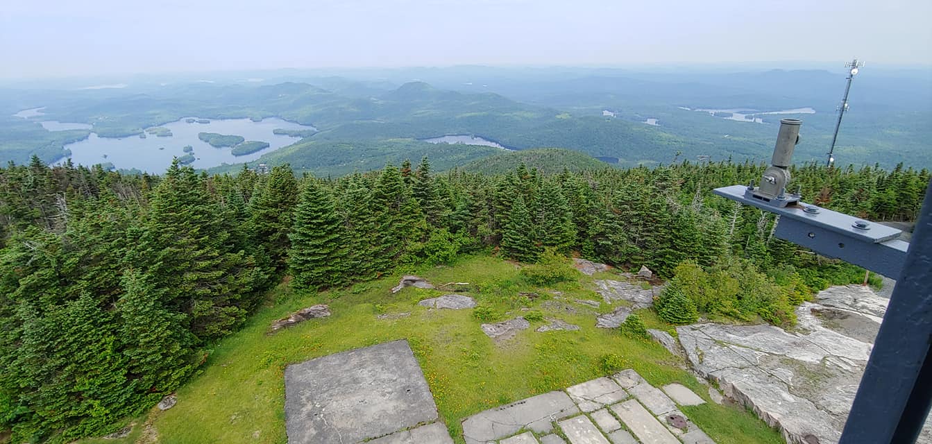
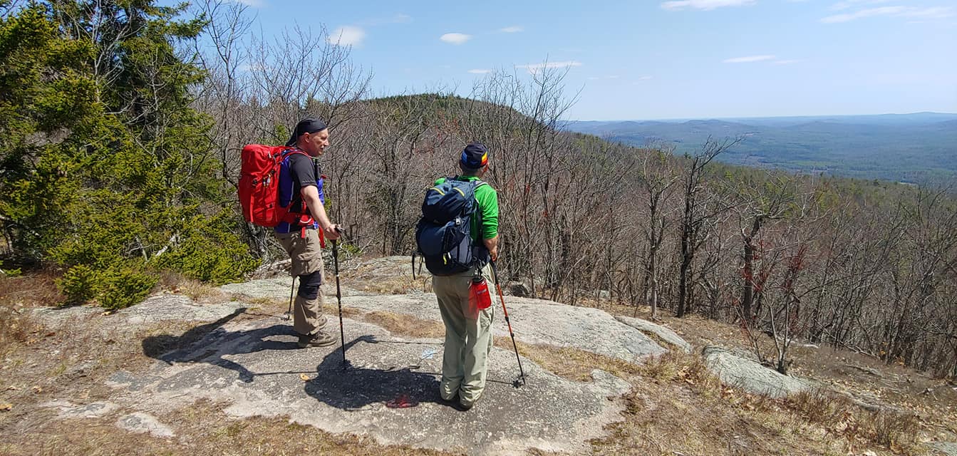
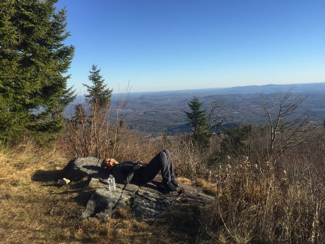
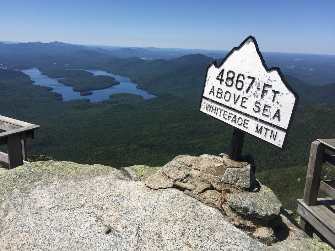
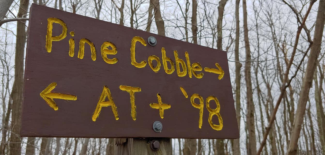
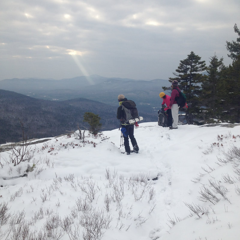
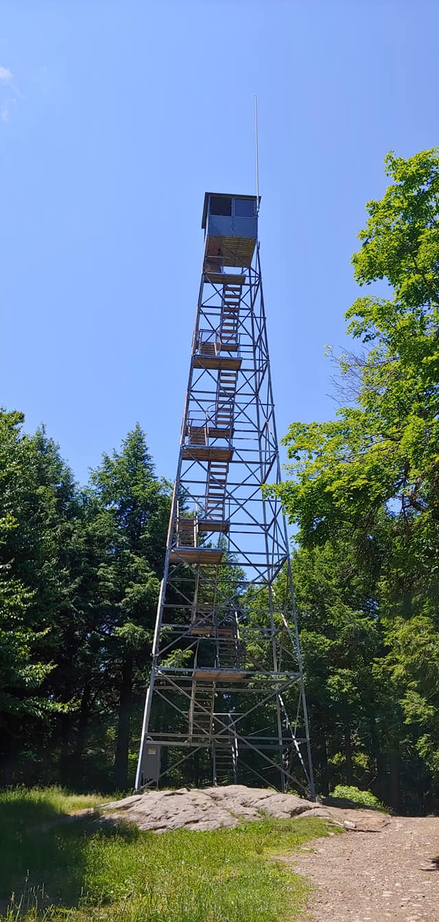


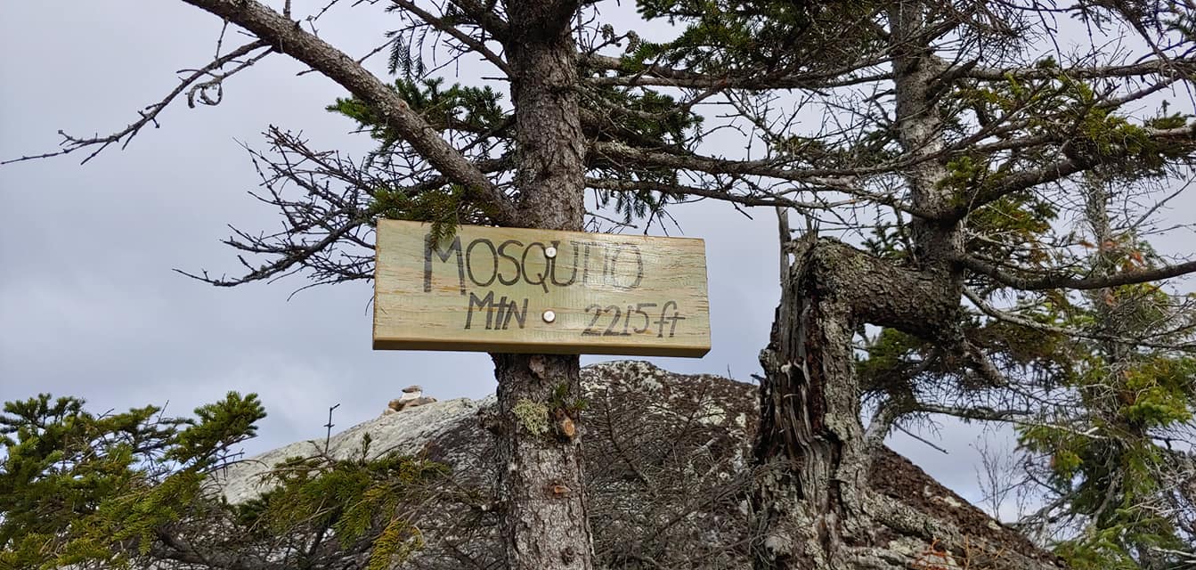
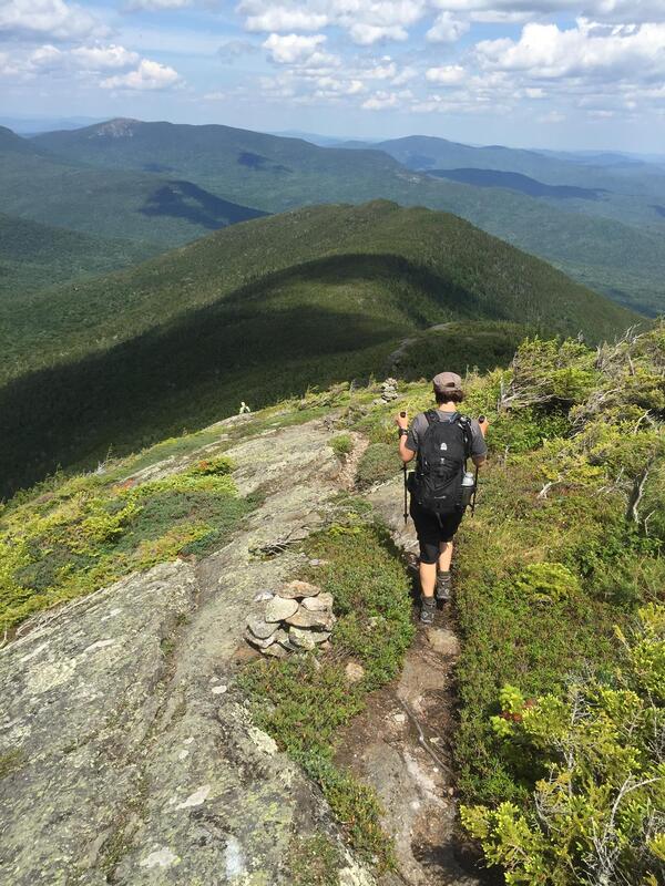
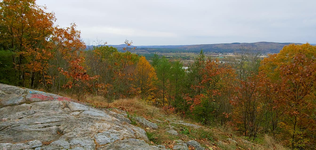
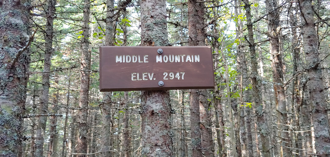

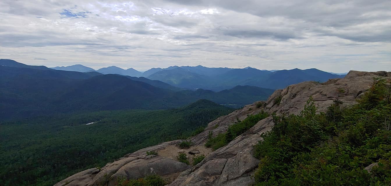


 RSS Feed