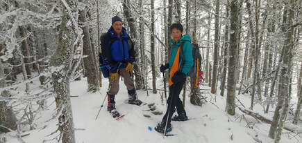
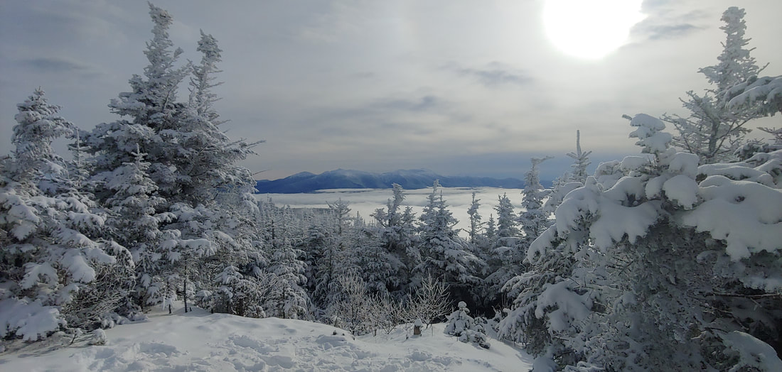
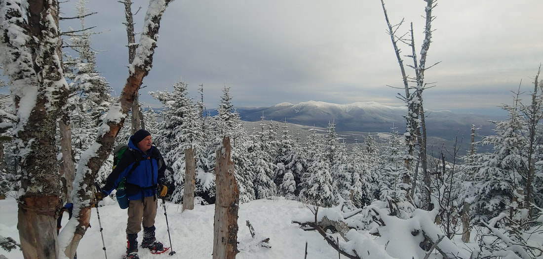
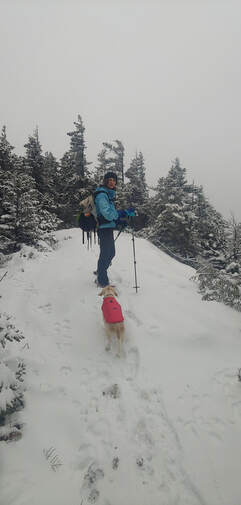
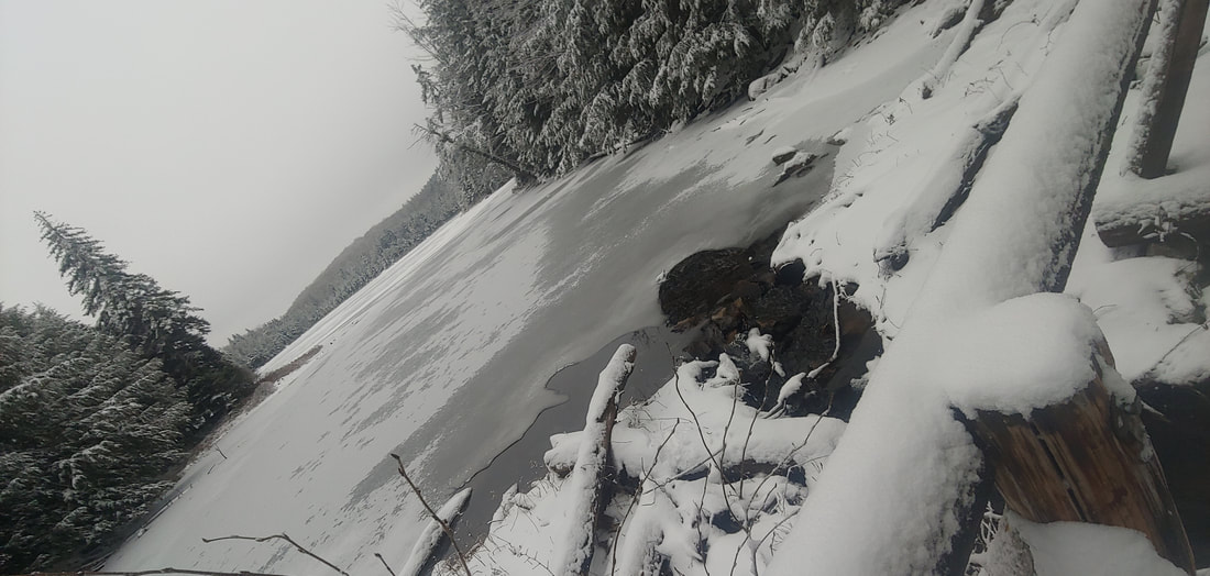
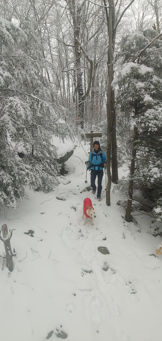
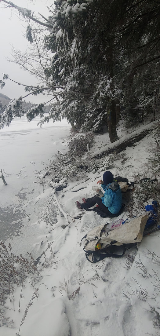
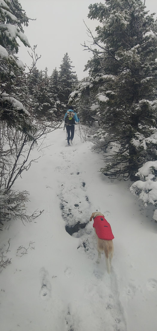
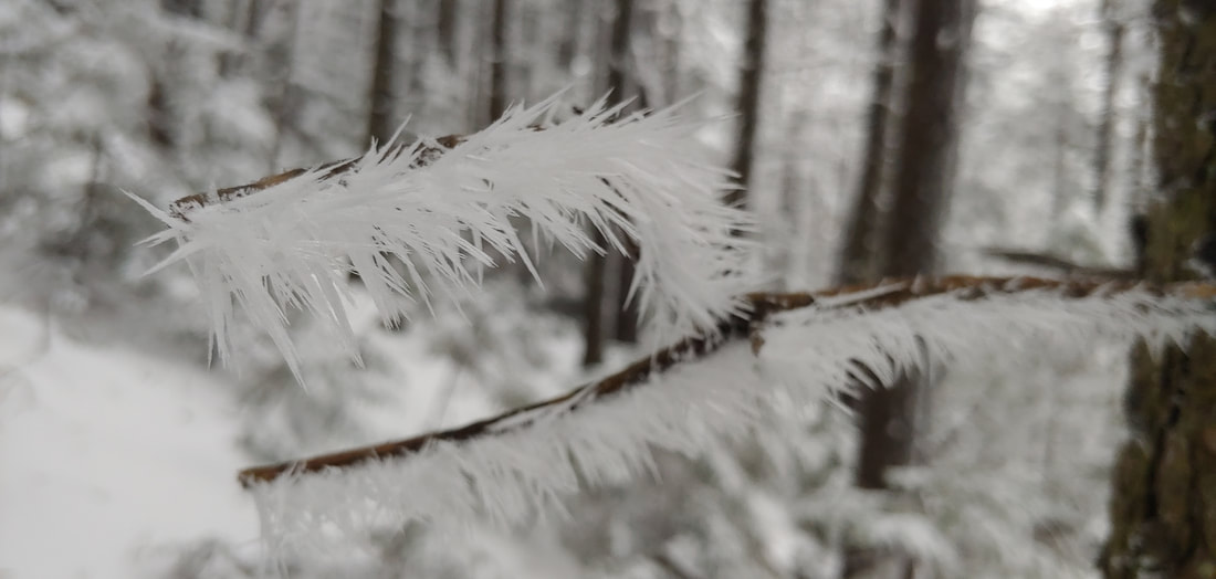
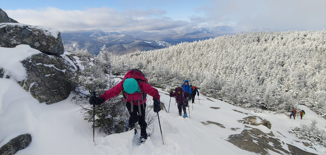
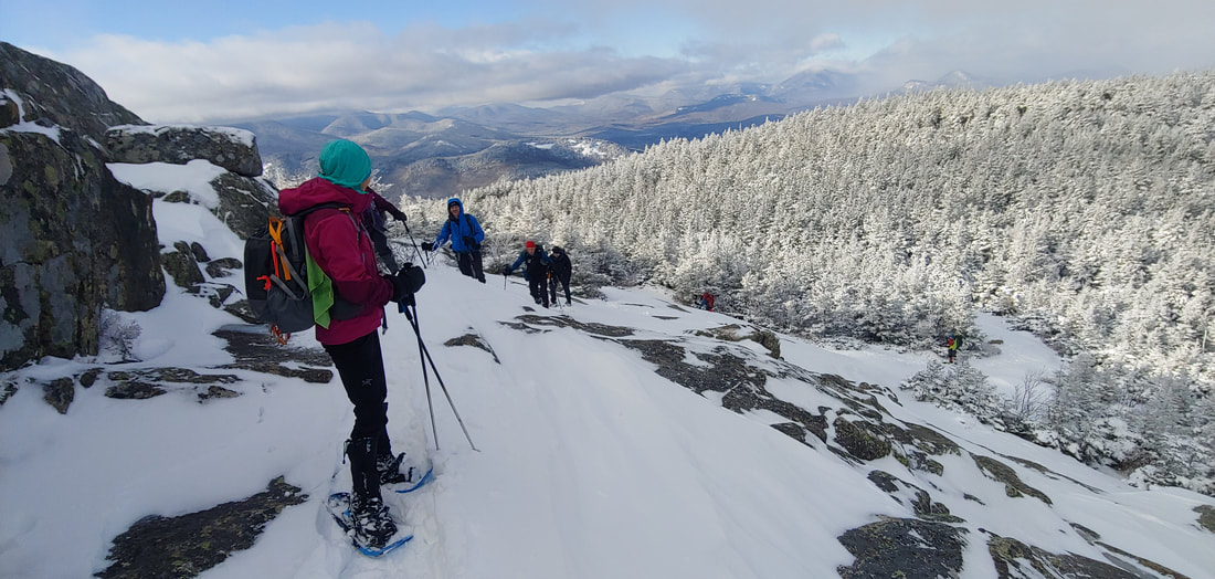
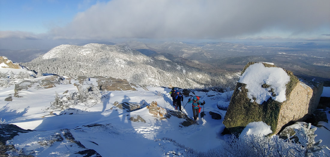
 Ken and Lucy standing over the tiny cairn marking the summit of South Weeks The three peaks of Weeks Mountain, 3,901', 3,885', and 3,684', named in honor of John Wingate Weeks (progenitor of the Migratory Bird Act and the Weeks Act, which enabled the creation of our National Forests), are located in The Kilkenny--the remote, northernmost part of the White Mountain National Forest. The three peaks aren't particularly interesting or unique: they are crowned by common spruce-fir forests and are viewless, generic, settings among so many similar 3,000+ foot summits in the northeast United States. But North Weeks and South Weeks are also members of the New England 100 Highest peaks list, for which there is a winter-season only patch--thus our reason for visiting South Weeks this winter. 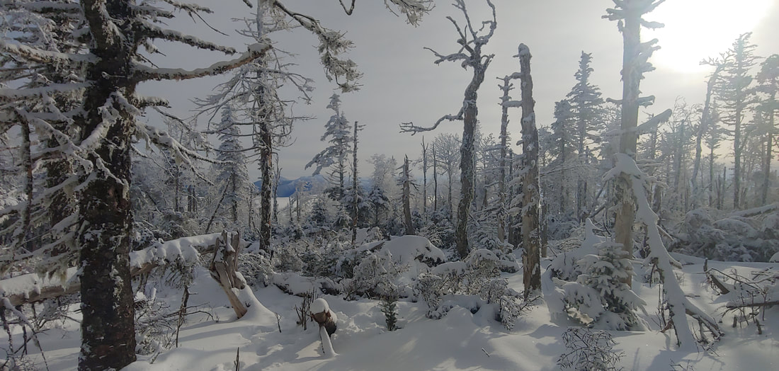 Glimpse of the Presidential Range from the ridge between South Weeks and Waumbek. The easiest way to visit South Weeks is OAB via the Kilkenny Ridge Trail, first passing over higher Mt. Starr King, 3,907', and Mt. Waumbek, 4,006' (52 With A View list and New Hampshire 4,000-Footer list, respectively), 12.2 miles round trip. The only real views on the hike are from Starr King, where there is a small clearing at the former site of a cabin, and from a relatively recent blowdown patch a few hundred feet north of Waumbek summit. Although the route up Starr King and Waumbek is relatively easy and usually well trodden out and maintained, beyond Waumbek things get wooly pretty fast. Because Kilkenny Ridge is infrequently hiked, it is low priority on the trail maintenance schedule. Blazes are fading and infrequent, "fir wave" blowdowns are common, and the fast-growing branches of evergreen saplings and hobblebush threaten to squeeze the trail out of existence. We had about a foot of unbroken powder on the ground, which made it harder to find our way. Thankfully the route sticks mostly to the ridgeline, so getting truly lost is only for the cartographically challenged. Where we did get brief views, we were blessed with an unusual day-long cloud undercast over which the Presidential Range to the south floated like a volcanic island chain. Beyond the simple pleasure of checking a peak off a list, the hike has its charm: on the whole, The Kilkenny has a wonderfully remote aura. It's the kind of place where the forest feels more dominant than the trail and the wildlife are more plentiful than human beings. We crossed at least sixty fresh moose tracks (some of which had re-crossed our snowshoes prints prior to our return) along with countless prints of smaller critters. The moose themselves were typically elusive--large as they are, they do blend and were likely able to see us well enough. The last time I had visited South Weeks was during a Kilkenny Ridge solo backpack in the early 1990s--as far as I can tell, not much has changed out there. Trees fall and grow back, moose make their rounds. The trail is as wooly was it was back then: it was like seeing an old friend who hadn't changed one bit in twenty-five years. --Paul-William Thanks to: White Mountain National Forest (land conservation, trails), Randolph Mountain Club (trails).
0 Comments
There are several ways to approach it: as a diversion during a long distance hike of the Long Trail, as a long loop using part of the Long Trail and Green Mountain Trail, or as an OAB approach starting on the Homer Stone Trail in Wallingford. Since it was winter, we opted for the shorter Homer Stone approach (about 7.0 miles RT, 1950' EG). The Homer Stone Trail ascends to the Long Trail at Little Rock Pond, starting out as a wide woods road and narrowing to a trail halfway up at an unbridged wet crossing of cascading Homer Stone Brook (tricky in winter or high water). From there, the Green Mountain Trail ascends steeply up a series of ledges which give way to some open viewpoints overlooking the pond 600 feet below (we had none on account of socked-in conditions). Had it been summer, we could have combined it with a dip in the pond or brook, or an overnight sleepover to the sound of water lapping stones (there are several primitive campsites on the pond). Although the trail skirts the true summit of the mountain, one can bushwhack 0.2 or so to the top where there is a little register jar tied to a tree, and a secret view ledge. I'll be adding Green Mountain to my rarified "pretty mountains with swimmable alpine ponds-list", among such excellent destinations as Tumbledown Mountain/Tumbledown Pond (ME), Sargent Mountain/Sargent Pond (Acadia National Park, ME), Old Speck Mountain/Speck Pond (ME), and Lonesome Lake/Cannon & Kinsman Mountain (NH). That'll be a topic for a 2022 summer post. Stay tuned. --Paul-William Thanks to: Green Mountain National Forest (land conservation & trails); Green Mountain Club (trails).
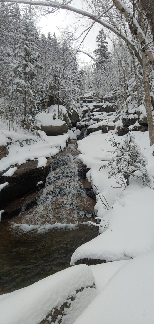
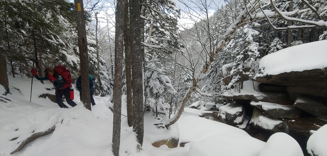
The OAB trail starts at the campground and ascends 1,080 feet in 1.7 miles, passing scenic cascades (with a few stepping-stone water crossings) and through a big-tree hemlock forest. Presumably the summit used to be bald back in the day. It no longer is, but there are two modest cleared window viewpoints at the top--one facing Stratton Mountain and another Mount Monadnock (in NH). Conditions were a bit icy during our ascent; our spikes made for good footing but the beagle had to fishtail his way up and down the mountain. Although our hike this day was intentionally short, one could easily make a longer day of it by also hiking the nearby Ledges Overlook Trail by Townshend Dam which loops over some cliffs on a hill to the northeast of Bald Mountain, and the trail to the impressive 125-foot Hamilton Falls just to the north in Jamaica, Vermont. --Paul-William 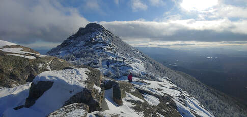 The icy summit cone of Chocorua When we think of the classic shape of a mountain--all pointy, barren, and snow capped--there are few peaks in the northeast United States that capture that archetype more than New Hampshire's Mount Chocorua in winter. Chocorua's conical, bald summit (3,490') has been a landmark destination for hikers for over 150 years and figures prominently in the folklore of the White Mountains: the mountain gets its name from the legend of a Native American by the same name who, according to fable, leaped to his death from the summit in culmination of cultural misunderstanding-double revenge- tragedy. Chocorua is one of my favorite peaks: delightfully climby and open; challenging but not an overly long hike--and I like to get to it at least once per year if I can. The mountain is also on the 52 With A View hiking list, which includes the finest sub-4K peaks in New Hampshire. A winter-conditions hike up the mountain seemed like a good fit for my hiking club--Random Group of Hikers--which was gearing up for a return after a long Covid-related hiatus, so I put it on the calendar. We had planned to do a loop starting at the popular Piper Trail from the south, but concerns about post-snowstorm parking area plowing at Piper caused me to change the approach to an OAB via the White Mountain National Forest's Champney Falls Trail from the north (7.6mi RT). The falls, which drop off a ledge into the side of a short slot canyon--are some of the most unique and impressive in the state. 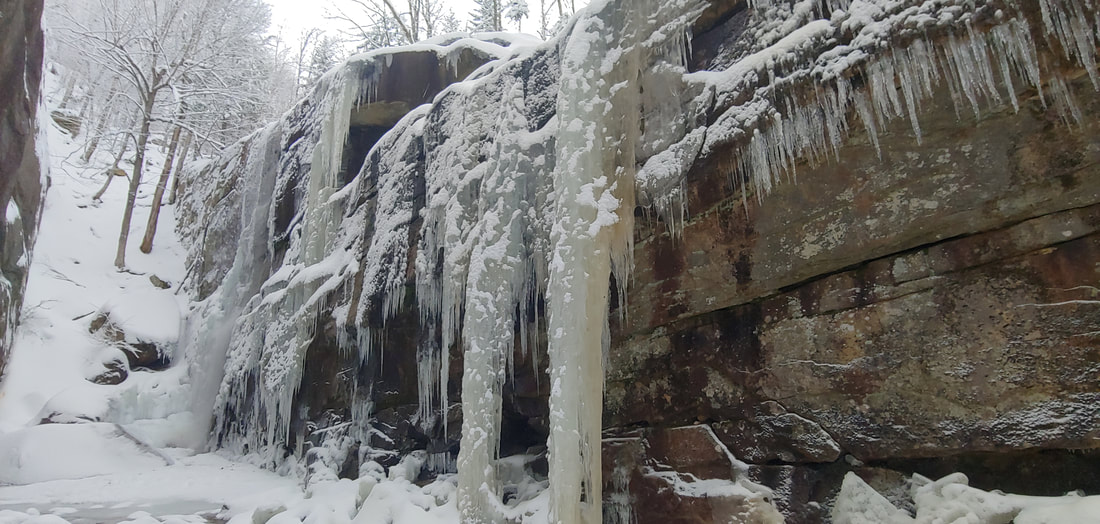 Impressive and unique Champney Falls enroute to Chocorua We got 5 inches of snow overnight, on top of a layer of black ice: snowshoes were on the menu for the ascent and light traction for descent, but crampons would not have been out of order on the summit cone of the mountain where a few ice bulges made for tricky scrambles. The falls were partially frozen and the four brook crossings unfrozen but manageable on stepping stones. Views from the top were glorious. --Paul-William |
TOPICS
All
Humor (The Parsnip)

|


 RSS Feed