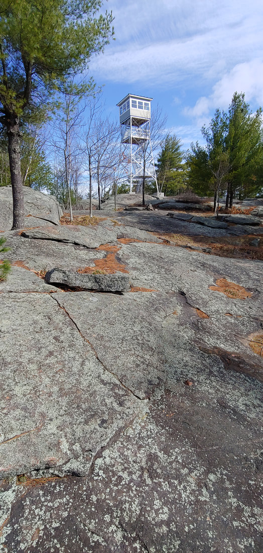
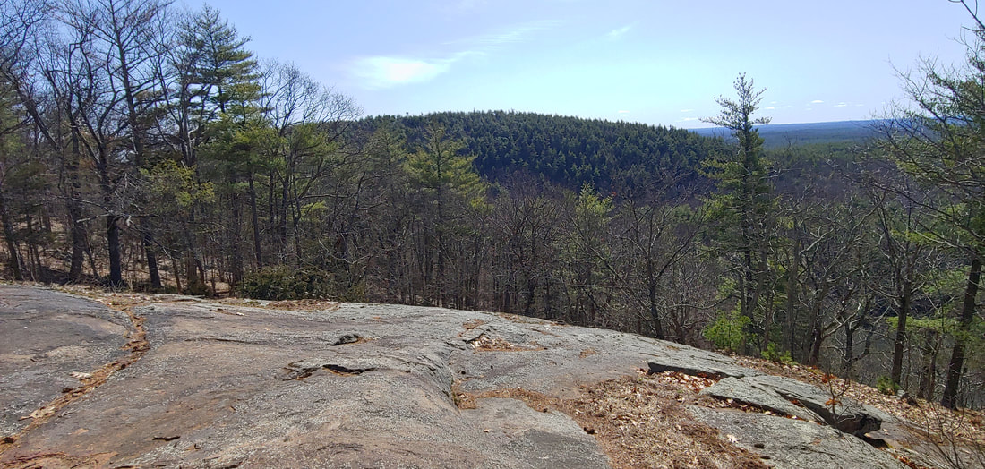
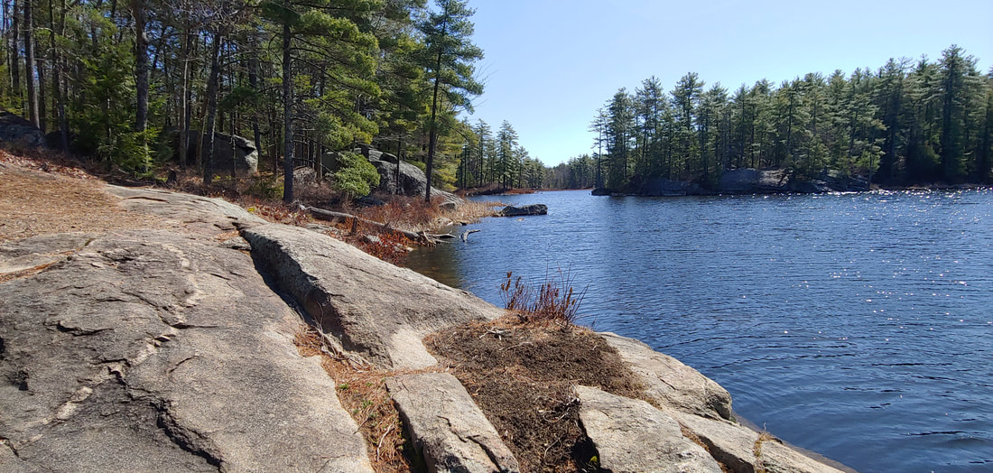
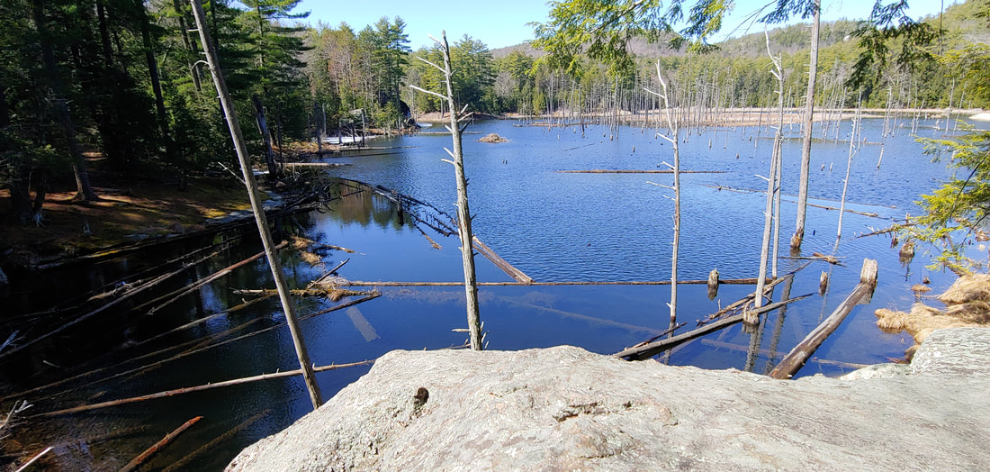
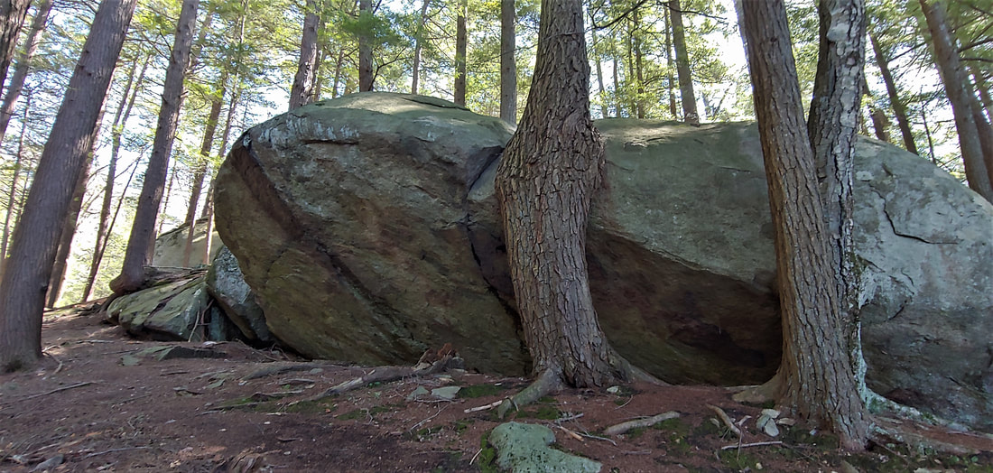
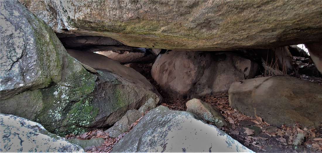
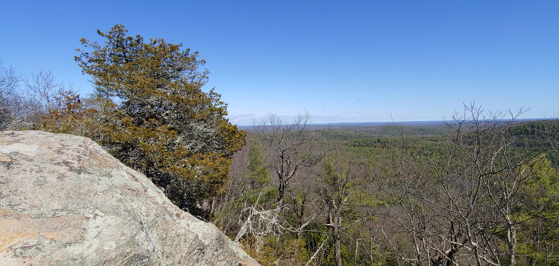
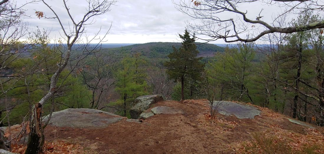
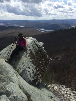
The Pawtuckaway boulder field is something to behold--it ranks up there with some of New England's most profound boulderscapes (Smuggler’s Notch, Carter Notch, Mahoosic Notch, etc.) in terms of its sheer number of boulders and its general bouldery goodness. Besides the boulders, one can hike up the three peaks of the mountain, as I did: South Mountain (908 feet), Middle Mountain (800ft) , and North Mountain (1,011ft). Don't let the low elevations fool you--Pawtuckaway makes up for it in a generosity of ruggedness. 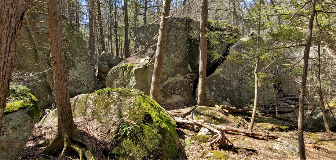 Pawtuckaway Boulder Field South Mountain hosts a well-curated fire tower and many open ledges and is a fine short hike in its own right. The out-and-back trail to Middle Mountain is an uninspiring woods road but there is a sweet, sunny ledge at the end of the trail (with a cameo of the South Mountain fire tower) and Middle Peak gets less visitation than the other two peaks. North Mountain is blessed with an excellent array of ledges and overlooks; its north slope plunges into a part of the boulder field colorfully known as the Devil’s Den. Amidst the fantastic mess of ledges and boulders in Pawtuckaway are nested a number of attractive ponds and wetlands. Round Pond, with its many lazy rock outcrops, is perhaps the most scenic of the park's water bodies. 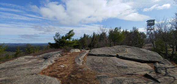 South Peak and its tower. A glance at a topographic map of Pawtuckaway reveals the mountain's unusual, graceful symmetry, a product of its past as a volcano--the great tooth of it worn down by the eons into an almost perfectly circular series of rocky stubs (in geologic terms, a "volcanic ring-dike"). Rim-to-rim, the old core of Pawtuckaway is about a mile across (there is also a smaller inner ring). Volcanic cores aren't unusual mountainforms in New England, but so few are well preserved in their original molten design as Pawtuckaway is. Even the continental ice sheet--which took its colossal wrecking ball to the north rim of the old volcano, tearing out a million boulders and strewing them like primitive toys below--hasn't ruined the pleasing topography of it.  Pawtuckaway's glorious volcanic symmetry: From NW to SE: North Mtn., Middle Mtn., South Mtn. The Boulder field is at one o'clock; Round pond is at two-thirty o'clock. To get to the start of my hike, I parked at Reservation Road, entering from Tandy Road in Deerfield, NH (amidst a comedy of Covid-era signs from the locals: "your GPS is wrong, go home" ). Parking does fill up fast—on sunny weekends it's wise to get there bright and early (don't even bother trying the limited north parking area on Round Pond Road—you won't beat the rock climbers vying for spots). Making the grand loop over South and North Mountain is pretty straightforward (South Mountain Trail to Boulder Trail, to North Mountain Trail and back to start) and a worthy loop, but squeezing in Middle Mountain, which is serviced only by a dead-end trail, requires some gymnastics (I cheated with a bushwhack shortcut). Shorter loops to just the North or South Mountain are also possible, and longer routes can be had from the park's lakefront entrance to the east at Pawtuckaway Pond (busy in summer) where there is also a campground. There are over 30 miles of trail in the park, including foot paths and woods roads. Some of the woods roads are multi-use trails--expect to see mountain bikers and in winter, snowmobilers. Although it was too early to try during my March visit, I suspect that Round Pond is a good place for a dip on a hot summer day. See the gallery below for more photographs of Pawtuckaway. I hope you will visit this fine bouldery wonderland of a mountain! --Paul-William 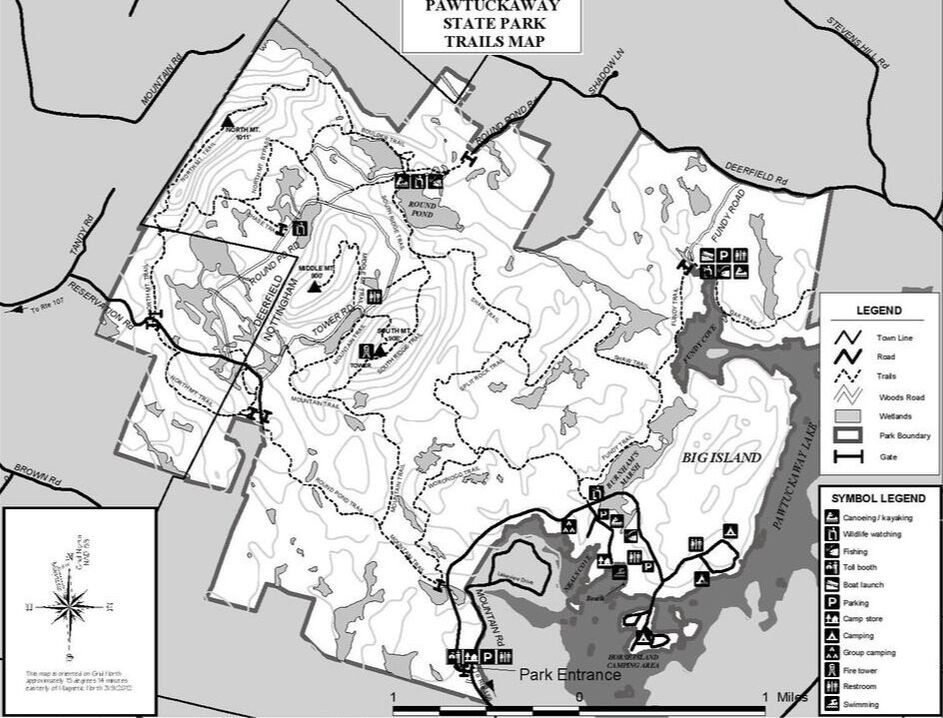
0 Comments
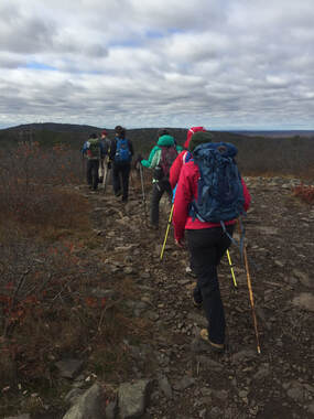
At this point I’m done with all that and looking for a taste of spring—or at least some snow free ground. If you’re of the same mind, the good news is that there are some really great mountain ranges to hike which melt out a lot sooner than the high peaks (by virtue of being further south, lower in elevation, or because they are covered primarily with deciduous trees). Here is a list of my favorite relatively snow-free mountain ranges to hike in the Northeast United States during the spring season. Not only will these mountain ranges melt out a lot sooner, they’re scenic, tough, rocky, and rewarding hikes that are worth visiting any time of the year. I briefly list and describe them below but will be following up with an in-depth profile on each range through April and May. (Note that camping options during the spring may be limited until Memorial Day weekend when campgrounds tend to open up, but other forms of lodging are likely to have vacancies and reduced rates in the spring).  Hiking the Belknap Range in spring. 1: THE BELKNAP RANGE Where: The Lakes Region, New Hampshire; about 1 hour south of the White Mountains and 100 miles northwest of Boston. What: Sixteen (more or less, depending on how you count them) summits, many with dramatic views of Lake Winnepesaukie and more open ledge than you can shake a stick at. Over 60 miles of trail: short, moderate and long loops, and long-distance traverses are possible. There is even a hiking patch challenge associated with completing a traverse of the Belknaps. Info: AMC Southern New Hampshire Guide and maps. Online Belknap Range map. 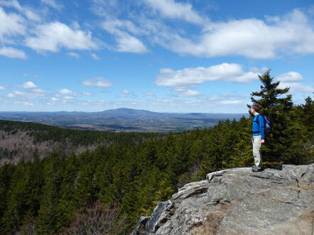 The Wapack Range's North Pack Monadnock in spring 2: THE WAPACK RANGE Where: South-central New Hampshire and adjacent Massachusetts, about an hour northwest of Boston. What: The 22-mile Wapack Trail traverses this linear mountain range over ten slabby peaks which poke up from dense coniferous and deciduous forests; there are excellent views over the surrounding rural countryside from the summits. Hikers tend to favor either a manageable 10-ish mile partial traverse or the full, difficult long-distance traverse, but there are also short and moderate loop options especially at the north and south ends of the range. Info: Wapack Range Guide and map, AMC Southern New Hampshire Guide and maps.
The terrain is surprisingly diverse with open ledges, rocky tarns, waterfalls, historic ruins, wetlands, a startling knife-edge arete, and talus slopes. Info: AMC Southern New Hampshire Guide and maps. Pisgah State Forest map, Wantastiquet to Monadnock Trail maps.  The view from Maiden Cliff in Maine's Camden Hills 4: THE CAMDEN HILLS Where: Maine seacoast, 1 hour and 40 minutes north of Portland. What: Rugged, rocky highlands with many open ledges and precipitous cliffs overlooking the Atlantic Ocean and inland lakes. Hikes are clustered around the Camden Hills State Park (6 peaks) and nearby along the Hills section of the Georges Highland Path (4 peaks), and there are several other satellite peaks to do as well. Short, moderate and long loops and traverses are possible; hiking all 13 peaks in the Hills region would add up to a very challenging experience. Info: Camden Hiking & Biking Map. AMC Maine Hiking Guide, Maine Trail Finder
Hikers often favor single traverses (depending on route, 7-9mi, circa 1,500ft eg) or double traverses (out-and-back) but the extensive, dense network of trails make for nearly unlimited short and long possibilities. Info: Blue Hills Reservation Map; AMC Massachusetts Trail Guide and maps. 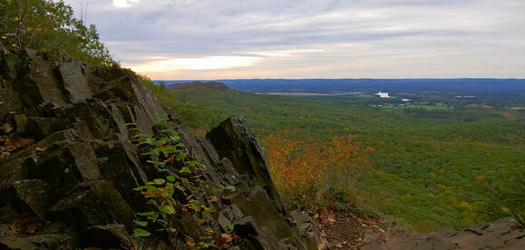 View from the cliffs of the Holyoke Range 6: THE HOLYOKE RANGE Where: The Pioneer Valley of Massachusetts, near the University of Massachusetts in Amherst; 45 minutes north of Hartford, CT. What: This unique, deeply fissured line of semi-open volcanic cliffs plunge up to 1,000 feet into the surrounding lowlands of the Connecticut River Valley. The Range offers a long, rollercoaster-tough traverse (about 14mi, 3,600eg), shorter segment traverses, and varied loop options. The New England National Scenic Trail traverses the crest of the range. Info: AMC Massachusetts Trail Guide and maps, Skinner/Mt. Holyoke Range State Park maps.
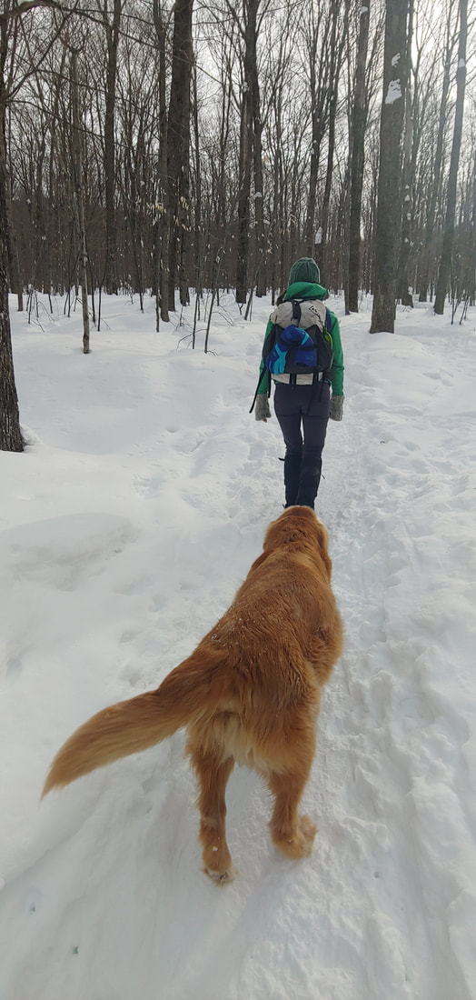
Short and long traverses, moderate and extended loops, and overnight backcountry treks are all possible. The Appalachian Trail traverses the east branch of the Range and the South Taconic Trail the west branch of the Range, with many shorter connecting trails between. Info: AMC Massachusetts Trail Guide and maps, NY-NJ Trail Conference South Taconic Trail Map. 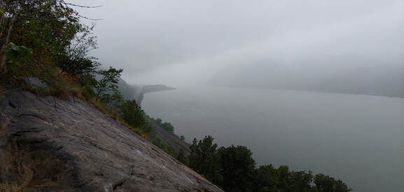 View of the Hudson River from the precipitous Breakneck Ridge in the Hudson Highlands 8: THE HUDSON HIGHLANDS Where: 1.0 to 1.5 hours north of New York City What: Over 100 miles of trails crisscross the mountains and hills of the Hudson Highlands on both sides of the Hudson River through several state parks, wildlife preserves, and non-profit conservation lands extending from the New Jersey border to the Connecticut border. Same-day or multi-day overnight backcountry trips and varied same-day loops are all possible. The long-distance Appalachian Trail and the Long Path traverse the Highlands. Some of the most dramatic and rugged terrain in the Northeast can be found where the Hudson River has gouged through the Highlands near Storm King and Bear Mountain (ex., the infamous Breakneck Ridge). Info: NY-NJ Trail Conference maps; ATC Appalachian New York-New Jersey Guide. Happy snowless spring hiking!--Paul-William 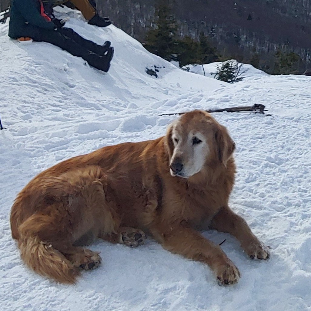 One could say that Stowe Pinnacle (2,651ft feet; Stowe, Vermont) has a dog, but it would be more accurate to say that dog has the Pinnacle. At one point, not too long ago, two dogs had Stowe Pinnacle: golden retrievers Sampson and Baylor. Sadly, Baylor passed away and now there is just Sampson. If you’ve hiked the mountain you have more than likely run into Sampson (and Baylor too, if you hiked it a few years ago). By all accounts (well chronicled in local newspapers; even made the subject of a documentary film) the dogs hiked the mountain on their own, without their owners, finding their own way up and down the mountain for over a decade, in all seasons, nearly every day--often multiple times per day. The dogs were such a routine presence on the mountain that it became impossible to think of the mountain and not also think of the dogs. The rest of us? Yeah, just tourists. Now the mountain is down to just one lord, Sampson. Stowe Pinnacle--the mountain apart from its lord--is a wonderful, pointy knob in Vermont's Worcester Range, a ridge parallel to the crest of the Green Mountains located directly east of Mount Mansfield (the highest summit in Vermont). The open summit of the Pinnacle is an excellent place from which to observe Mansfield across the Stowe Valley. You can get to the top by way of the Stowe Pinnacle Trail, 1.8 miles one way (and you can keep going—over the Hogback and on to Mount Hunger and other peaks). Chances are excellent that you will run into Sampson along the way.
The Pinnacle is the perfect place to share with good company, lingeringly in good weather or briefly in bad—and I suspect Sampson needs our company more than ever since his companion Baylor passed away. This life has many rewards if you only look, but immortality certainly isn’t one of them. A mountain. . .a view. . .a dog. . .good company. Maybe a sunset. If that were our only reward, it might be enough. 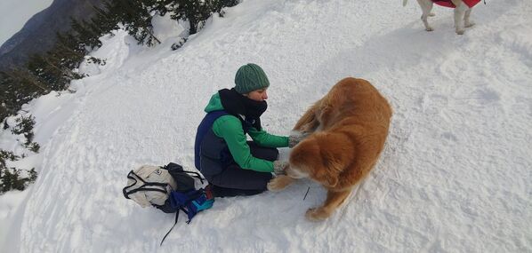 Elizabeth picking ice balls out of Sampson's paws.
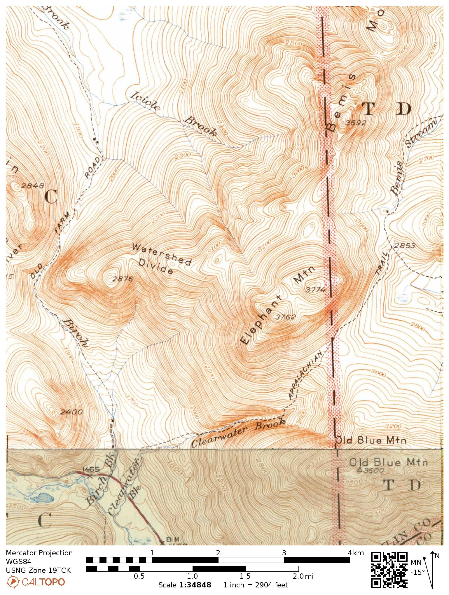
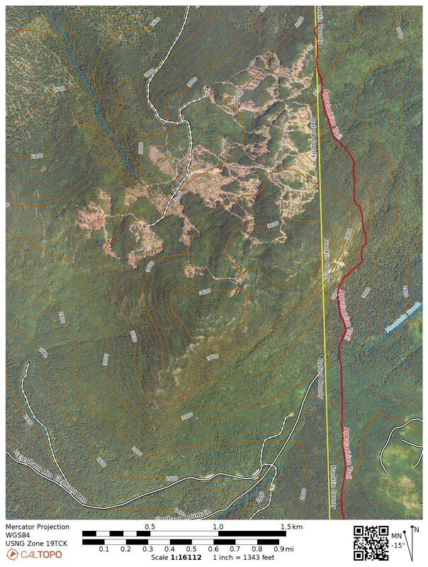
Elephant, on the other hand, just lurks, wooly with fir trees, hunching over its smaller neighbors. On that account alone it could very well be called Wooly Mammoth or just Mammoth. The mountain’s only claim to notoriety is its height—just enough to qualify for inclusion in New England's 100 highest peaks portfolio (at #98). If not for the list, the only people who might visit it would be foresters, loggers, hunters (none likely going as far as the summit), and an occasional wildlife biologist conducting research on Canada lynx or pine marten.
Skid trails continue further up the mountain, and from there several herd paths choices continue the rest of the way (the herd paths are tricky to parse in deep snow). In summer, the round-trip hike is 6-ish miles; in winter between 7 and 9 miles depending on approach. The primary logging road is located off South Arm Road, (a good gravel public way) about 8 miles north of Andover.
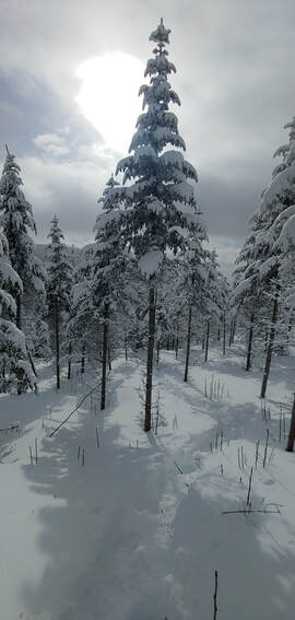
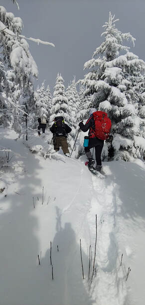
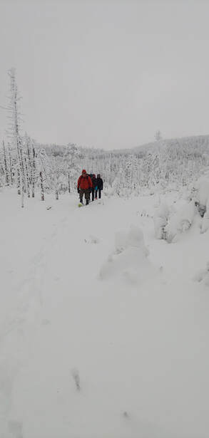
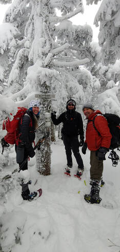
I chose to do Elephant in winter when the evidence of logging was buried in deep snow and the thinned, frost-capped saplings made for idyllic, postcard scenery. It took me two trips: the first, a late-start solo, breaking trail through knee-deep and deeper snow to 3,400 feet, and the second (with a few friends) going the rest of the way. For the second trip, I brought my skis and made good time both up and down the logging roads.
|
TOPICS
All
Humor (The Parsnip)

|

 RSS Feed