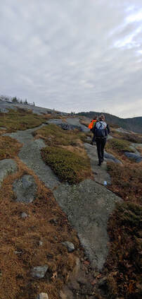
At this point I’m done with all that and looking for a taste of spring—or at least some snow free ground. If you’re of the same mind, the good news is that there are some really great mountain ranges to hike which melt out a lot sooner than the high peaks (by virtue of being further south, lower in elevation, or because they are covered primarily with deciduous trees). Here is a list of my favorite relatively snow-free mountain ranges to hike in the Northeast United States during the spring season. Not only will these mountain ranges melt out a lot sooner, they’re scenic, tough, rocky, and rewarding hikes that are worth visiting any time of the year. I briefly list and describe them below but will be following up with an in-depth profile on each range through April and May. (Note that camping options during the spring may be limited until Memorial Day weekend when campgrounds tend to open up, but other forms of lodging are likely to have vacancies and reduced rates in the spring). 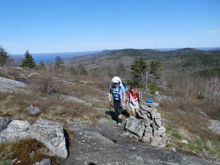 Hiking the Belknap Range in spring. 1: THE BELKNAP RANGE Where: The Lakes Region, New Hampshire; about 1 hour south of the White Mountains and 100 miles northwest of Boston. What: Sixteen (more or less, depending on how you count them) summits, many with dramatic views of Lake Winnepesaukie and more open ledge than you can shake a stick at. Over 60 miles of trail: short, moderate and long loops, and long-distance traverses are possible. There is even a hiking patch challenge associated with completing a traverse of the Belknaps. Info: AMC Southern New Hampshire Guide and maps. Online Belknap Range map. 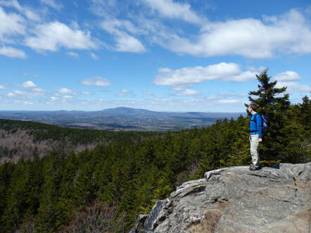 The Wapack Range's North Pack Monadnock in spring 2: THE WAPACK RANGE Where: South-central New Hampshire and adjacent Massachusetts, about an hour northwest of Boston. What: The 22-mile Wapack Trail traverses this linear mountain range over ten slabby peaks which poke up from dense coniferous and deciduous forests; there are excellent views over the surrounding rural countryside from the summits. Hikers tend to favor either a manageable 10-ish mile partial traverse or the full, difficult long-distance traverse, but there are also short and moderate loop options especially at the north and south ends of the range. Info: Wapack Range Guide and map, AMC Southern New Hampshire Guide and maps.
The terrain is surprisingly diverse with open ledges, rocky tarns, waterfalls, historic ruins, wetlands, a startling knife-edge arete, and talus slopes. Info: AMC Southern New Hampshire Guide and maps. Pisgah State Forest map, Wantastiquet to Monadnock Trail maps. 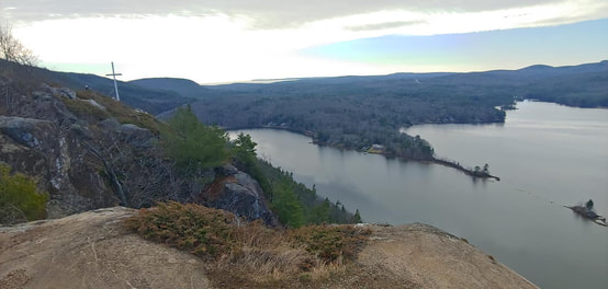 The view from Maiden Cliff in Maine's Camden Hills 4: THE CAMDEN HILLS Where: Maine seacoast, 1 hour and 40 minutes north of Portland. What: Rugged, rocky highlands with many open ledges and precipitous cliffs overlooking the Atlantic Ocean and inland lakes. Hikes are clustered around the Camden Hills State Park (6 peaks) and nearby along the Hills section of the Georges Highland Path (4 peaks), and there are several other satellite peaks to do as well. Short, moderate and long loops and traverses are possible; hiking all 13 peaks in the Hills region would add up to a very challenging experience. Info: Camden Hiking & Biking Map. AMC Maine Hiking Guide, Maine Trail Finder
Hikers often favor single traverses (depending on route, 7-9mi, circa 1,500ft eg) or double traverses (out-and-back) but the extensive, dense network of trails make for nearly unlimited short and long possibilities. Info: Blue Hills Reservation Map; AMC Massachusetts Trail Guide and maps. 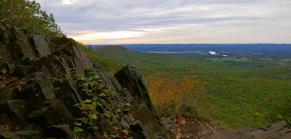 View from the cliffs of the Holyoke Range 6: THE HOLYOKE RANGE Where: The Pioneer Valley of Massachusetts, near the University of Massachusetts in Amherst; 45 minutes north of Hartford, CT. What: This unique, deeply fissured line of semi-open volcanic cliffs plunge up to 1,000 feet into the surrounding lowlands of the Connecticut River Valley. The Range offers a long, rollercoaster-tough traverse (about 14mi, 3,600eg), shorter segment traverses, and varied loop options. The New England National Scenic Trail traverses the crest of the range. Info: AMC Massachusetts Trail Guide and maps, Skinner/Mt. Holyoke Range State Park maps.
Short and long traverses, moderate and extended loops, and overnight backcountry treks are all possible. The Appalachian Trail traverses the east branch of the Range and the South Taconic Trail the west branch of the Range, with many shorter connecting trails between. Info: AMC Massachusetts Trail Guide and maps, NY-NJ Trail Conference South Taconic Trail Map. 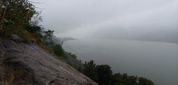 View of the Hudson River from the precipitous Breakneck Ridge in the Hudson Highlands 8: THE HUDSON HIGHLANDS Where: 1.0 to 1.5 hours north of New York City What: Over 100 miles of trails crisscross the mountains and hills of the Hudson Highlands on both sides of the Hudson River through several state parks, wildlife preserves, and non-profit conservation lands extending from the New Jersey border to the Connecticut border. Same-day or multi-day overnight backcountry trips and varied same-day loops are all possible. The long-distance Appalachian Trail and the Long Path traverse the Highlands. Some of the most dramatic and rugged terrain in the Northeast can be found where the Hudson River has gouged through the Highlands near Storm King and Bear Mountain (ex., the infamous Breakneck Ridge). Info: NY-NJ Trail Conference maps; ATC Appalachian New York-New Jersey Guide. Happy snowless spring hiking!--Paul-William
1 Comment
Thank you for the thrilling adventure snow travel insights! Your blog has been a beacon of inspiration as we plan our snowy escapade. From gear recommendations to safety tips, your expertise has been invaluable in preparing us for an unforgettable journey. Grateful for your dedication to sharing your experiences and knowledge! Leave a Reply. |
TOPICS
All
Humor (The Parsnip)

|
 RSS Feed